Ruta 4 y Juan XXIII
Ruta 4 y Juan XXIII is a bus stop in Almirante Brown Partido, Buenos Aires. Ruta 4 y Juan XXIII is situated nearby to the park Plaza Perfumo, as well as near the church Parroquia Santos Pedro y Pablo.| Tap on a place to explore it |
Places of Interest Nearby
Highlights include Burzaco Station and Emilio Burgwardt Hospital.
Burzaco Station
Railway station

Photo: Gustavo Durante, CC BY-SA 4.0.
Burzaco Station is a railway station, which is situated 2½ km east of Ruta 4 y Juan XXIII.
Emilio Burgwardt Hospital
Hospital
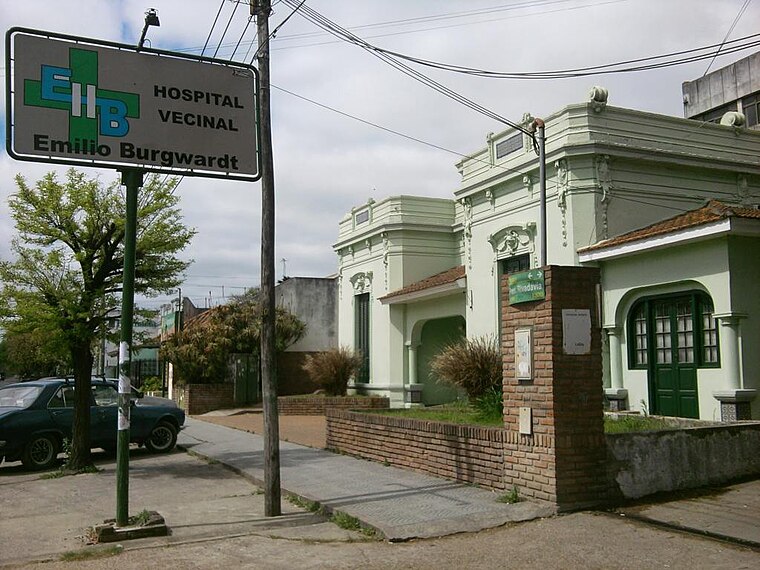
Photo: Wikimedia, CC BY-SA 3.0.
The Emilio Burgwardt Hospital is a hospital located in Longchamps, in the southern area of the Greater Buenos Aires. It is administered and owned by a civic society, Sociedad de Fomento Emilio Burgwardt. Emilio Burgwardt Hospital is situated 4 km southeast of Ruta 4 y Juan XXIII.
Llavallol train station
Railway station

Photo: Hurfer, CC BY-SA 4.0.
Llavallol train station is a railway station, which is situated 4 km north of Ruta 4 y Juan XXIII.
Places in the Area
Nearby places include Burzaco and Longchamps.
Burzaco
Town

Photo: Ulises Icardi, CC BY-SA 4.0.
Burzaco is a city in Almirante Brown Partido, Buenos Aires Province, Argentina. It has an area of 22.77 km2, holds a population of 98,859. It is 27 kilometres from Buenos Aires city, to which it is linked by the Ferrocarril General Roca South.
Longchamps
Town
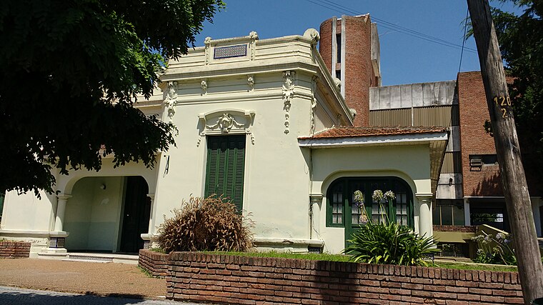
Photo: Wikimedia, CC BY-SA 2.0.
Longchamps is a city in Greater Buenos Aires, Argentina, located about 30 km south of Buenos Aires, in the Almirante Brown Partido. The city is named for the race track of the same name located on the Route des Tribunes in the Bois de Boulogne at Paris, France, after which the Sociedad Hípica de Lomas de Zamora was inspired to name the city's own racecourse. Longchamps is situated 4 km southeast of Ruta 4 y Juan XXIII.
Llavallol
Town

Photo: Yo gdg, CC BY-SA 3.0.
Llavallol is a district of Lomas de Zamora Partido in Buenos Aires Province, Argentina. It forms part of the Greater Buenos Aires urban conurbation. The settlement was named in honour of Felipe Llavallol who governed Buenos Aires between the end of the Battle of Cepeda and 1860. Llavallol is situated 4 km north of Ruta 4 y Juan XXIII.
Ruta 4 y Juan XXIII
- Type: Bus stop
- Category: transportation
- Location: Almirante Brown Partido, Buenos Aires, Pampas, Argentina, South America
- View on OpenStreetMap
Latitude
-34.83044° or 34° 49′ 50″ southLongitude
-58.41537° or 58° 24′ 55″ westOpen location code
48Q35H9M+RVOpenStreetMap ID
node 10828523684OpenStreetMap feature
highway=bus_stopOpenStreetMap feature
public_transport=platform
This page is based on OpenStreetMap, Wikidata, and Wikimedia Commons.
We’d love your help improving our open data sources. Thank you for contributing.
Satellite Map
Discover Ruta 4 y Juan XXIII from above in high-definition satellite imagery.
Notable Places Nearby
Highlights include Plaza Perfumo and Parroquia Santos Pedro y Pablo.
Nearby Places
Explore places such as Ruta 4 y Ameghino and Burmetal.
Buenos Aires: Must-Visit Destinations
Delve into Buenos Aires, La Plata, Mar del Plata, and Centro.
Curious Bus Stops to Discover
Uncover intriguing bus stops from every corner of the globe.
About Mapcarta. Data © OpenStreetMap contributors and available under the Open Database License". Text is available under the CC BY-SA 4.0 license, except for photos, directions, and the map. Photo: Mbusin, CC BY-SA 4.0.