Landform
Landform is a work of art in Edinburgh, Scotland. Landform is situated nearby to the art gallery Modern One, as well as near Café Sun Terrace.| Tap on a place to explore it |
Places of Interest Nearby
Highlights include Modern Two and Edinburgh Castle.
Modern Two
Art gallery

Photo: Grousebeater2, CC BY-SA 4.0.
Modern Two, formerly the Dean Gallery, in Edinburgh, is one of the two buildings housing the Scottish National Gallery of Modern Art, one of Scotland's national art galleries. Modern Two is situated 590 feet east of Landform.
Edinburgh Castle
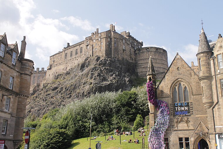
Photo: Stephencdickson, CC BY-SA 4.0.
Edinburgh Castle is a historic castle in Edinburgh, Scotland. It stands on Castle Rock, which has been occupied by humans since at least the Iron Age. There has been a royal castle on the rock since the reign of Malcolm III in the 11th century, and the castle continued to be a royal residence until 1633. Edinburgh Castle is situated 1 mile east of Landform.
Dean Cemetery
Cemetery

Photo: Stephencdickson, CC BY-SA 4.0.
The Dean Cemetery is a historically important Victorian cemetery north of the Dean Village, west of Edinburgh city centre, in Scotland. It lies between Queensferry Road and the Water of Leith, bounded on its east side by Dean Path and on its west by the Dean Gallery. Dean Cemetery is situated 980 feet northeast of Landform.
Places in the Area
Nearby places include West Coates and Dean Village.
West Coates
Neighborhood

Photo: Stephencdickson, CC BY-SA 4.0.
West Coates or Wester Coates is a residential district of central Edinburgh, the capital of Scotland. It is on the A8, in proximity to Haymarket railway station and Roseburn, west of the city centre, bounded by the Water of Leith on its north side.
Dean Village
Suburb

Photo: 瑞丽江的河水, CC BY-SA 4.0.
Dean Village is a former village immediately northwest of the city centre of Edinburgh, Scotland. It is bounded by Belford Road to the south and west, Belgrave Crescent Gardens to the north and below the Dean Bridge to the east.
Haymarket
Suburb

Photo: Kim Traynor, CC BY-SA 3.0.
Haymarket is an area of Edinburgh, Scotland. It is in the west of the city centre and is the junction of several main roads, notably Dalry Road, Corstorphine Road, and Shandwick Place. Haymarket contains a number of pubs, cafés and restaurants.
Landform
- Type: Work of art
- Artwork type: installation
- Category: tourism
- Location: Edinburgh, Scotland, United Kingdom, Britain and Ireland, Europe
- View on OpenStreetMap
Latitude
55.95131° or 55° 57′ 5″ northLongitude
-3.22695° or 3° 13′ 37″ westOpen location code
9C7RXQ2F+G6OpenStreetMap ID
node 11190384094OpenStreetMap feature
tourism=artworkOpenStreetMap attribute
artwork_type=installation
This page is based on OpenStreetMap, Wikidata, and Wikimedia Commons.
We’d love your help improving our open data sources. Thank you for contributing.
Satellite Map
Discover Landform from above in high-definition satellite imagery.
Notable Places Nearby
Highlights include Modern One and Café Sun Terrace.
Nearby Places
Explore places such as Personnage and Femme.
Edinburgh: Must-Visit Destinations
Delve into Old Town, New Town, West Edinburgh, and Leith.
Curious Work Of Arts to Discover
Uncover intriguing work of arts from every corner of the globe.
About Mapcarta. Data © OpenStreetMap contributors and available under the Open Database License". Text is available under the CC BY-SA 4.0 license, except for photos, directions, and the map. Photo: Wikimedia, CC BY 3.0.