War of the worlds mosiac
War of the worlds mosiac is a work of art in Woking District, Surrey, England. War of the worlds mosiac is situated nearby to Chobham Road Bridge, as well as near the art gallery The Lightbox.| Tap on a place to explore it |
Places of Interest Nearby
Highlights include The Lightbox and New Victoria Theatre.
The Lightbox
Art gallery

Photo: The Lightbox, CC BY-SA 4.0.
The Lightbox is a public gallery and museum located in Woking, Surrey, in the South East of England. Three galleries host a range of exhibitions, changing regularly and it has a free museum of local history - 'Woking's Story'.
New Victoria Theatre
Theater building

Photo: Murgatroyd49, CC BY-SA 4.0.
The New Victoria Theatre in Woking, England opened in June 1992. The main theatre seats approximately 1,300 people, making it one of the largest receiving house theatres outside London. New Victoria Theatre is situated 660 feet southwest of War of the worlds mosiac.
Christ Church
Church
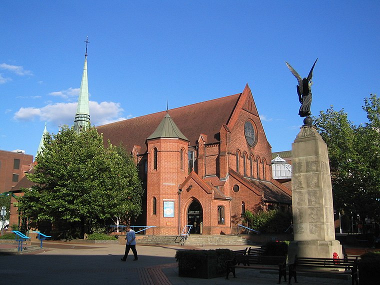
Photo: AlanFord, Public domain.
Christ Church is located in Woking, England. The church is in the Diocese of Guildford. Christ Church is situated 620 feet south of War of the worlds mosiac.
Places in the Area
Nearby places include Woking and Horsell.
Woking

Photo: Wikimedia, CC BY-SA 3.0.
Woking is the other large town in Surrey apart from Guildford. It is home to Henry VIII's Royal Palace.
Horsell
Village
Horsell is a village in the borough of Woking in Surrey, England, less than a mile north-west of Woking town centre. In November 2012, its population was 9,384.
Old Woking
Village

Photo: John Salmon, CC BY-SA 2.0.
Old Woking is a ward and the original settlement of the town and borough of Woking, Surrey, about 1.3 miles southeast of the modern town centre. It is bounded by the Hoe Stream to the north and the River Wey to the south and between Kingfield to the west and farmland to the east.
War of the worlds mosiac
- Type: Work of art
- Category: tourism
- Location: Woking District, Surrey, South East England, England, United Kingdom, Britain and Ireland, Europe
- View on OpenStreetMap
Latitude
51.3216° or 51° 19′ 18″ northLongitude
-0.55758° or 0° 33′ 27″ westOpen location code
9C3X8CCR+JXOpenStreetMap ID
node 11380051551OpenStreetMap feature
tourism=artwork
This page is based on OpenStreetMap, Wikidata, and Wikimedia Commons.
We’d love your help improving our open data sources. Thank you for contributing.
Satellite Map
Discover War of the worlds mosiac from above in high-definition satellite imagery.
Notable Places Nearby
Highlights include Chobham Road Bridge and H G Wells Centre.
Nearby Places
Explore places such as McLaren Applied and Victoria Gate.
Surrey: Must-Visit Destinations
Delve into Guildford, Woking, Godalming, and Epsom.
Curious Work Of Arts to Discover
Uncover intriguing work of arts from every corner of the globe.
About Mapcarta. Data © OpenStreetMap contributors and available under the Open Database License". Text is available under the CC BY-SA 4.0 license, except for photos, directions, and the map. Photo: Wikimedia, CC0.