Beestentoren
Beestentoren is in Zutendaal, Hasselt, Flanders. Beestentoren is situated nearby to the park Lieteberg, as well as near the maze Het Labyrint (Blotevoetenpad).| Tap on a place to explore it |
Places of Interest Nearby
Highlights include Onze-Lieve-Vrouwekerk (Zutendaal) and Zutendaal.
Onze-Lieve-Vrouwekerk (Zutendaal)
Church

Photo: Sonuwe, CC BY-SA 3.0.
Onze-Lieve-Vrouwekerk (Zutendaal) is a church, which is situated 1¼ km north of Beestentoren.
Zutendaal
Aerodrome
Zutendaal Air Base is a reserve Belgian Air Component base, located 4 mi east-southeast of Genk, approximately 50 mi east-northeast of Brussels. Zutendaal is situated 3 km northeast of Beestentoren.
Suetendaelmolen
Watermill

Photo: Paul Hermans, CC BY-SA 4.0.
Suetendaelmolen is a watermill, which is situated 2 km west of Beestentoren.
Places in the Area
Nearby places include De Hoefaert and Asbeek.
De Hoefaert
Locality

Photo: Paul Hermans, CC BY-SA 4.0.
De Hoefaert is a locality, which is situated 3½ km south of Beestentoren.
Asbeek
Locality

Photo: EvilFreD, CC BY-SA 4.0.
Asbeek is a locality, which is situated 4 km east of Beestentoren.
Munsterbilzen
Village
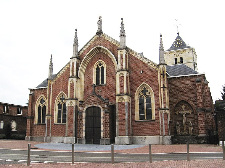
Photo: Sonuwe, CC BY-SA 3.0.
Munsterbilzen is a village, which is situated 5 km southwest of Beestentoren.
Beestentoren
Latitude
50.92168° or 50° 55′ 18″ northLongitude
5.5728° or 5° 34′ 22″ eastOpen location code
9F27WHCF+M4OpenStreetMap ID
node 11607191608OpenStreetMap feature
tourism=information
This page is based on OpenStreetMap, Wikidata, and Wikimedia Commons.
We’d love your help improving our open data sources. Thank you for contributing.
Satellite Map
Discover Beestentoren from above in high-definition satellite imagery.
Notable Places Nearby
Highlights include Lieteberg and Het Labyrint (Blotevoetenpad).
Nearby Places
Explore places such as Vlinderserre and Lieteberg.
Limburg: Must-Visit Destinations
Delve into Sint-Truiden, Tongeren, Genk, and Maasmechelen.
Curious Places to Discover
Uncover intriguing places from every corner of the globe.
About Mapcarta. Data © OpenStreetMap contributors and available under the Open Database License". Text is available under the CC BY-SA 4.0 license, except for photos, directions, and the map. Photo: Jeanhousen, CC BY 3.0.