Three Locks Main Road
Three Locks Main Road is a bus stop in Soulbury, Aylesbury Vale, England. Three Locks Main Road is situated nearby to the golf course Three Locks Golf Club, as well as near the village Heath and Reach.| Tap on a place to explore it |
Places of Interest Nearby
Highlights include Soulbury and Church of St Luke.
Soulbury
Stone

Photo: Richard Thomas, CC BY-SA 2.0.
Soulbury is a village and also a civil parish within the unitary authority area of Buckinghamshire, England. It is located in the Aylesbury Vale, about seven miles south of Central Milton Keynes, and three miles north of Wing. Soulbury is situated 1 mile southwest of Three Locks Main Road.
Church of St Luke
Church

Photo: Mr Biz, CC BY-SA 2.0.
Church of St Luke is situated 1 mile northwest of Three Locks Main Road.
St Mary the Virgin, Great Brickhill
Church
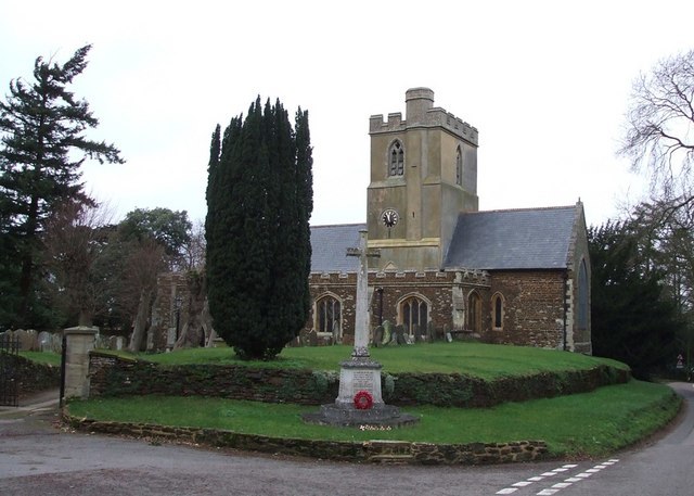
Photo: Rob Farrow, CC BY-SA 2.0.
St Mary the Virgin's Church, Great Brickhill is a Grade II* listed parish church in the Church of England in Great Brickhill, Buckinghamshire. St Mary the Virgin, Great Brickhill is situated 1½ miles northeast of Three Locks Main Road.
Places in the Area
Nearby places include Heath and Reach and Newton Leys.
Heath and Reach
Village
Heath and Reach is a village and civil parish near the Chiltern Hills in Bedfordshire, England. It is 2 miles north of Leighton Buzzard and 3 miles south of Woburn and adjoins the county boundary with Buckinghamshire. Heath and Reach is situated 2 miles east of Three Locks Main Road.
Newton Leys
Suburb
Newton Leys is an area that covers the southern tip of Bletchley and straddles the boundary between the City of Milton Keynes and the rest of Buckinghamshire. Newton Leys is situated 2½ miles northwest of Three Locks Main Road.
Linslade
Town

Photo: Wikimedia, CC BY-SA 2.0.
Linslade is an area in the civil parish of Leighton-Linslade, in the Central Bedfordshire unitary authority area of Bedfordshire, England. The original village was at Old Linslade on the banks of the River Ouzel. Linslade is situated 2½ miles southeast of Three Locks Main Road.
Three Locks Main Road
- Type: Bus stop
- Category: transportation
- Location: Soulbury, Aylesbury Vale, Buckinghamshire, South East England, England, United Kingdom, Britain and Ireland, Europe
- View on OpenStreetMap
Latitude
51.94717° or 51° 56′ 50″ northLongitude
-0.70599° or 0° 42′ 22″ westOpen location code
9C3XW7WV+VJOpenStreetMap ID
node 11901588734OpenStreetMap feature
highway=bus_stopOpenStreetMap feature
public_transport=platform
This page is based on OpenStreetMap, Wikidata, and Wikimedia Commons.
We’d love your help improving our open data sources. Thank you for contributing.
Satellite Map
Discover Three Locks Main Road from above in high-definition satellite imagery.
Notable Places Nearby
Highlights include Three Locks Golf Club and Stoke Hammond Community Centre.
Nearby Places
Explore places such as Three Locks Main Road and The Three Locks.
Buckinghamshire: Must-Visit Destinations
Delve into Milton Keynes, Aylesbury, High Wycombe, and Buckingham.
Curious Bus Stops to Discover
Uncover intriguing bus stops from every corner of the globe.
About Mapcarta. Data © OpenStreetMap contributors and available under the Open Database License". Text is available under the CC BY-SA 4.0 license, except for photos, directions, and the map. Photo: Wikimedia, CC0.