Stoke Hammond Methodist Church
Stoke Hammond Methodist Church is a church in Stoke Hammond, Aylesbury Vale, England. Stoke Hammond Methodist Church is situated nearby to Stoke Hammond Post Office, as well as near Church of St Luke.| Tap on a place to explore it |
Places of Interest Nearby
Highlights include Church of St Luke and Soulbury.
Church of St Luke
Church

Photo: Mr Biz, CC BY-SA 2.0.
Church of St Luke is situated 960 feet north of Stoke Hammond Methodist Church.
Soulbury
Stone

Photo: Richard Thomas, CC BY-SA 2.0.
Soulbury is a village and also a civil parish within the unitary authority area of Buckinghamshire, England. It is located in the Aylesbury Vale, about seven miles south of Central Milton Keynes, and three miles north of Wing. Soulbury is situated 1½ miles south of Stoke Hammond Methodist Church.
St Mary the Virgin, Great Brickhill
Church
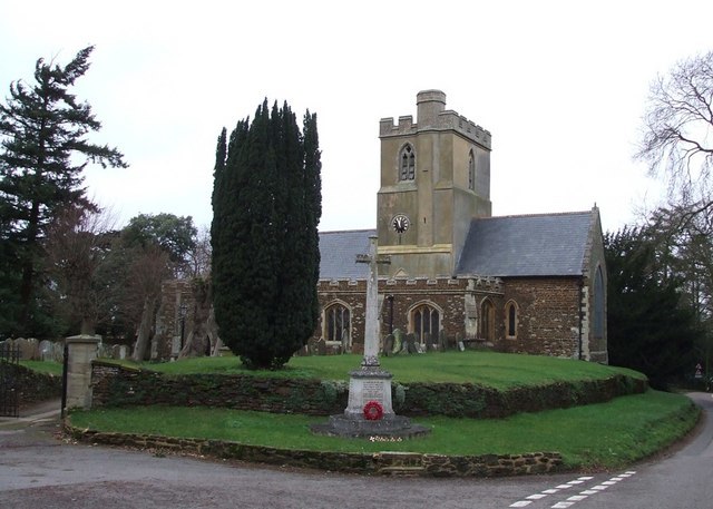
Photo: Rob Farrow, CC BY-SA 2.0.
St Mary the Virgin's Church, Great Brickhill is a Grade II* listed parish church in the Church of England in Great Brickhill, Buckinghamshire. St Mary the Virgin, Great Brickhill is situated 1½ miles northeast of Stoke Hammond Methodist Church.
Places in the Area
Nearby places include Newton Leys and Water Eaton.
Newton Leys
Suburb
Newton Leys is an area that covers the southern tip of Bletchley and straddles the boundary between the City of Milton Keynes and the rest of Buckinghamshire.
Water Eaton
Suburb

Photo: Mr Biz, CC BY-SA 2.0.
Water Eaton is an area of Milton Keynes, Buckinghamshire, England and in the civil parish of Bletchley and Fenny Stratford. It is to the south of Fenny Stratford and contiguous with it. Water Eaton is situated 2 miles north of Stoke Hammond Methodist Church.
Bletchley
Town

Photo: Tom walker, CC BY 3.0.
Bletchley is a constituent town of Milton Keynes, Buckinghamshire, England, in the south-west of the city, split between the civil parishes of Bletchley and Fenny Stratford and West Bletchley, which In 2011 had a combined population of 37,114. Bletchley is situated 2½ miles north of Stoke Hammond Methodist Church.
Stoke Hammond Methodist Church
- Type: Church
- Denomination: Methodist
- Categories: place of worship and religion
- Location: Stoke Hammond, Aylesbury Vale, Buckinghamshire, South East England, England, United Kingdom, Britain and Ireland, Europe
- View on OpenStreetMap
Latitude
51.95697° or 51° 57′ 25″ northLongitude
-0.72025° or 0° 43′ 13″ westOpen location code
9C3XX74H+QWOpenStreetMap ID
node 1230671947OpenStreetMap feature
amenity=place_of_worshipOpenStreetMap attribute
denomination=methodist
This page is based on OpenStreetMap, Wikidata, and Wikimedia Commons.
We’d love your help improving our open data sources. Thank you for contributing.
Satellite Map
Discover Stoke Hammond Methodist Church from above in high-definition satellite imagery.
Notable Places Nearby
Highlights include Stoke Hammond Post Office and Stoke Hammond Community Centre.
Nearby Places
Explore places such as Stoke Hammond Food & Wine and The Green.
Buckinghamshire: Must-Visit Destinations
Delve into Milton Keynes, Aylesbury, High Wycombe, and Buckingham.
Curious Churches to Discover
Uncover intriguing churches from every corner of the globe.
About Mapcarta. Data © OpenStreetMap contributors and available under the Open Database License". Text is available under the CC BY-SA 4.0 license, except for photos, directions, and the map. Photo: Wikimedia, CC0.