Sentiero dei Franchi
Sentiero dei Franchi is in Oulx, Province of Turin, Piedmont. Sentiero dei Franchi is situated nearby to the public building A.S.L., as well as near the bridge Ponte Ange Gardien.| Tap on a place to explore it |
Places of Interest Nearby
Highlights include Oulx–Cesana–Claviere–Sestriere railway station and San Rocco.
Oulx–Cesana–Claviere–Sestriere railway station
Railway station
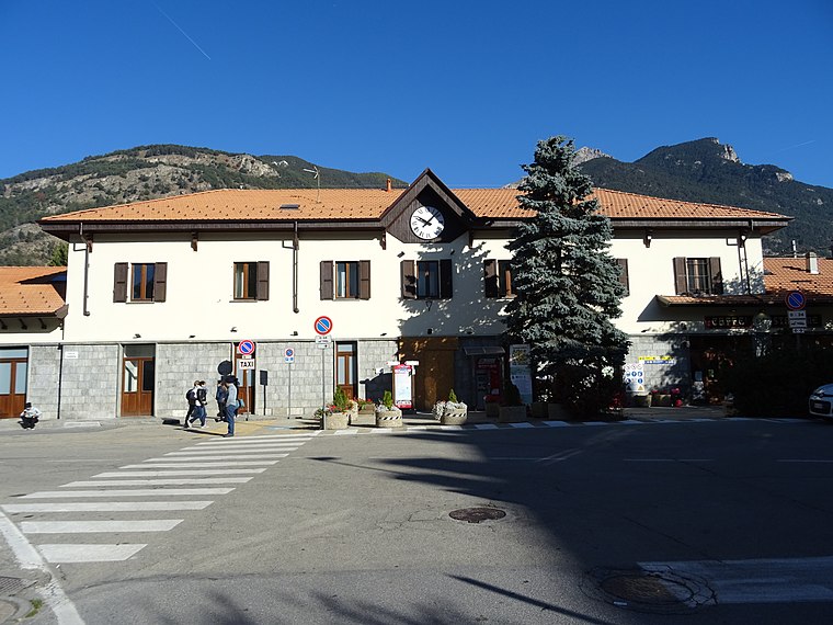
Photo: Remontees, CC BY-SA 4.0.
Oulx–Cesana–Claviere–Sestriere is a railway station in the Oulx comune in the Italian region of Piedmont. The station is located on the Turin–Modane railway. The train services are operated by Trenitalia and SNCF. Oulx–Cesana–Claviere–Sestriere railway station is situated 560 metres northwest of Sentiero dei Franchi.
San Rocco
Church

Photo: Martj9, CC BY-SA 4.0.
San Rocco is a church, which is situated 680 metres southwest of Sentiero dei Franchi.
Riserva naturale dello Stagno di Oulx
Nature reserve

Photo: M.chifari, CC BY-SA 4.0.
Riserva naturale dello Stagno di Oulx is a nature reserve.
Places in the Area
Nearby places include Gad and Signols.

Signols
Hamlet

Photo: Jks93, Public domain.
Signols is a hamlet, which is situated 3 km west of Sentiero dei Franchi.
Savoulx
Hamlet

Photo: Jks93, Public domain.
Savoulx is a hamlet, which is situated 4 km west of Sentiero dei Franchi.
Sentiero dei Franchi
- Type: Map
- Categories: information and tourism
- Location: Oulx, Province of Turin, Piedmont, Northwest Italy, Italy, Europe
- View on OpenStreetMap
Latitude
45.03635° or 45° 2′ 11″ northLongitude
6.83771° or 6° 50′ 16″ eastOpen location code
8FQ82RPQ+G3OpenStreetMap ID
node 12020399056OpenStreetMap feature
tourism=information
This page is based on OpenStreetMap, Wikidata, and Wikimedia Commons.
We’d love your help improving our open data sources. Thank you for contributing.
Satellite Map
Discover Sentiero dei Franchi from above in high-definition satellite imagery.
Places with the Same Name
Discover other places named “Sentiero dei Franchi”.
Notable Places Nearby
Highlights include A.S.L. and Ponte Ange Gardien.
Nearby Places
Explore places such as Rieduka and Vanity.
Piedmont: Must-Visit Destinations
Delve into Turin, Novara, Asti, and Alessandria.
Curious Places to Discover
Uncover intriguing places from every corner of the globe.
About Mapcarta. Data © OpenStreetMap contributors and available under the Open Database License". Text is available under the CC BY-SA 4.0 license, except for photos, directions, and the map. Photo: Martj9, CC BY-SA 4.0.