Rode Kruis Bocholt-Kaulille
Rode Kruis Bocholt-Kaulille is a community center in Bocholt, Arrondissement of Maaseik, Flanders. Rode Kruis Bocholt-Kaulille is situated nearby to the community center Hondenschool De Trouwe Vriend, as well as near the pitch Petanqueclub Bocholt.| Tap on a place to explore it |
Places of Interest Nearby
Highlights include Damburg and St. Lawrence’s Church, Bocholt.
Damburg
Building

Photo: Koen Nijsen, CC BY-SA 4.0.
Damburg is a building, which is situated 280 metres northeast of Rode Kruis Bocholt-Kaulille.
St. Lawrence’s Church, Bocholt
Church
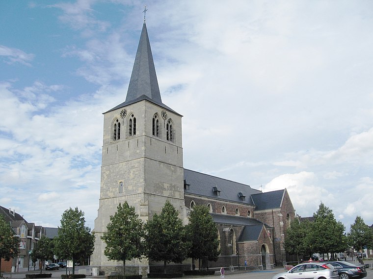
Photo: Sonuwe, CC BY-SA 3.0.
St. Lawrence's Church is the parish church of Bocholt, Belgium, dedicated to Saint Lawrence. St. Lawrence’s Church, Bocholt is situated 1 km northeast of Rode Kruis Bocholt-Kaulille.

Places in the Area
Nearby places include Reppel and Beek.

Beek
Village
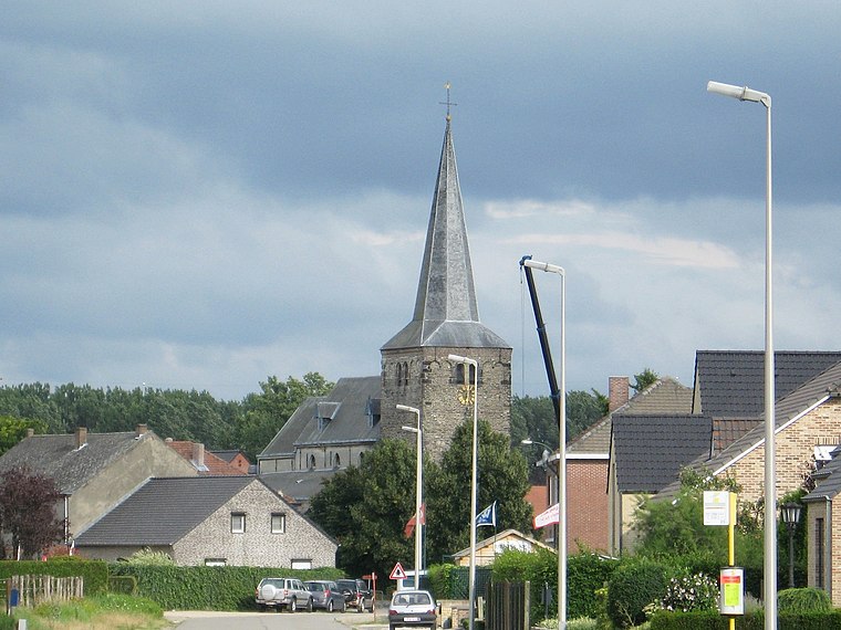
Photo: Sonuwe, CC BY-SA 3.0.
Beek is a village, which is situated 2½ km southeast of Rode Kruis Bocholt-Kaulille.
Bree
Town

Photo: Sonuwe, CC BY-SA 3.0.
Bree is a municipality and city in the Flemish province of Limburg, Belgium. In December 2021, Bree had a total population of 16,097. The total area is 64.96 km2 which gives it a population density of 246 inhabitants per square kilometre. Bree is situated 3½ km southeast of Rode Kruis Bocholt-Kaulille.
Rode Kruis Bocholt-Kaulille
- Type: Community center
- Location: Bocholt, Arrondissement of Maaseik, Limburg, Flanders, Belgium, Benelux, Europe
- View on OpenStreetMap
Latitude
51.16674° or 51° 10′ 0″ northLongitude
5.56983° or 5° 34′ 11″ eastOpen location code
9F375H89+MWOpenStreetMap ID
node 12331221669OpenStreetMap feature
amenity=community_centre
This page is based on OpenStreetMap, Wikidata, and Wikimedia Commons.
We’d love your help improving our open data sources. Thank you for contributing.
Satellite Map
Discover Rode Kruis Bocholt-Kaulille from above in high-definition satellite imagery.
Notable Places Nearby
Highlights include Petanqueclub Bocholt and Hondenschool De Trouwe Vriend.
Nearby Places
Explore places such as P3 and P6.
Limburg: Must-Visit Destinations
Delve into Sint-Truiden, Hasselt, Tongeren, and Genk.
Curious Community Centers to Discover
Uncover intriguing community centers from every corner of the globe.
About Mapcarta. Data © OpenStreetMap contributors and available under the Open Database License". Text is available under the CC BY-SA 4.0 license, except for photos, directions, and the map. Photo: Paul Hermans, CC BY-SA 3.0.