Les Derroces
Les Derroces is a locality in Villaviciosa, Asturias. Les Derroces is situated nearby to the locality Balesta, as well as near La Cantera.| Tap on a place to explore it |
Places of Interest
Highlights include Museo de la Escuela Rural de Asturias and Iglesia de Santa María.
Museo de la Escuela Rural de Asturias
Museum
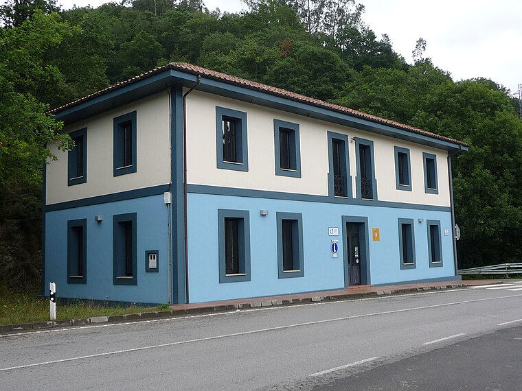
Photo: Zato-ino, CC BY-SA 4.0.
Museo de la Escuela Rural de Asturias is a museum.
Iglesia de Santa María
Church

Photo: Adolfobrigido, CC BY-SA 3.0.
Iglesia de Santa María is a church in Asturias, Spain.

Places in the Area
Nearby places include Santolaya and Sietes.
Santolaya
Village
Santolaya is one of six parishes in Cabranes, a municipality within the province and autonomous community of Asturias, in northern Spain. It is 5.85 km2 in size with a population of 336. Santolaya is situated 2½ km south of Les Derroces.
Sietes
Hamlet

Photo: Rodelar, CC BY-SA 4.0.
Sietes is a hamlet, which is situated 4 km east of Les Derroces.
Valdebárzana
Hamlet

Photo: Carmenmoran, CC BY 4.0.
Valdebárzana is a hamlet, which is situated 4½ km west of Les Derroces.
Les Derroces
- Type: Locality
- Location: Villaviciosa, Asturias, Green Spain, Spain, Iberia, Europe
- View on OpenStreetMap
Latitude
43.44045° or 43° 26′ 26″ northLongitude
-5.4158° or 5° 24′ 57″ westOpen location code
8CMPCHRM+5MOpenStreetMap ID
node 1242840146OpenStreetMap feature
place=locality
This page is based on OpenStreetMap, Wikidata, and Wikimedia Commons.
We’d love your help improving our open data sources. Thank you for contributing.
Satellite Map
Discover Les Derroces from above in high-definition satellite imagery.
Localities in the Area
Explore places such as Balesta and La Cantera.
Notable Places Nearby
Highlights include Peredi and Pelamanta.
Asturias: Must-Visit Destinations
Delve into Gijón, Grado, Salas, and Grandas de Salime.
Curious Localities to Discover
Uncover intriguing localities from every corner of the globe.
About Mapcarta. Data © OpenStreetMap contributors and available under the Open Database License". Text is available under the CC BY-SA 4.0 license, except for photos, directions, and the map. Photo: MickStephenson, CC BY-SA 3.0.