Huddersfield Methodist Mission
Huddersfield Methodist Mission is a church in Kirklees, England. Huddersfield Methodist Mission is situated nearby to Huddersfield Parish Church, as well as near The Vulcan Public House.| Tap on a place to explore it |
- Type: Church
- Denomination: Methodist
- Wheelchair access: yes
Places of Interest Nearby
Highlights include Huddersfield railway station and Kingsgate, Huddersfield.
Huddersfield railway station
Railway station

Photo: Richard Harvey, CC BY 3.0.
Huddersfield railway station serves the town of Huddersfield in West Yorkshire, England. The station is managed by TransPennine Express, which provides trains between Manchester and Liverpool in the North West and Newcastle and Redcar in the North East and also to York, Scarborough and Hull via Leeds. Huddersfield railway station is situated 1,000 feet west of Huddersfield Methodist Mission.
Kingsgate, Huddersfield
Shopping center
The Kingsgate Shopping Centre is a shopping centre in Huddersfield located to the west of Shorehead Roundabout and East of the junction of King Street and Queen Street and Cross Church Street. Kingsgate, Huddersfield is situated 720 feet south of Huddersfield Methodist Mission.
Lawrence Batley Theatre
Theater building
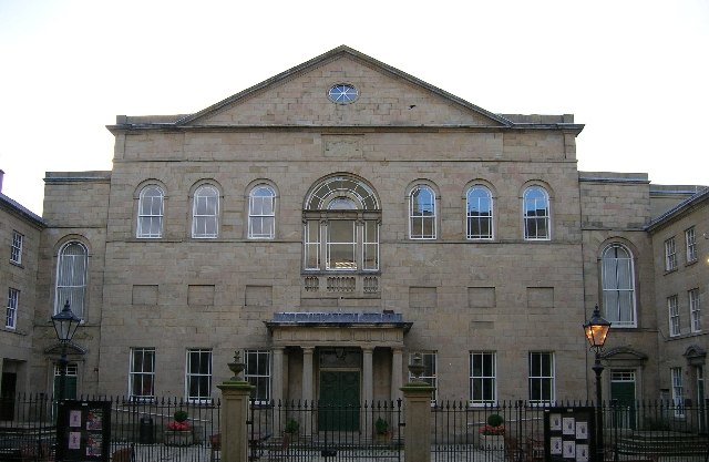
Photo: Ian M, CC BY-SA 2.0.
Lawrence Batley Theatre is a theatre in Huddersfield, West Yorkshire, England which offers drama, music, dance and comedy. The theatre is named after Lawrence Batley, a local entrepreneur and philanthropist, who founded a nationwide cash and carry chain. Lawrence Batley Theatre is situated 900 feet south of Huddersfield Methodist Mission.
Places in the Area
Nearby places include Huddersfield and Aspley.
Huddersfield

Photo: donald judge, CC BY 2.0.
Huddersfield is in the metropolitan borough of Kirklees in West Yorkshire in England. This article covers the town of Huddersfield, and the district around it including the Colne and Holme valleys.
Aspley
Suburb
Aspley is an area adjacent to the ring road around Huddersfield, Kirklees, West Yorkshire, England. It comprises a mixture of independent shops, commercial units, a small retail park, houses, student accommodation and sections of the University of Huddersfield and Kirklees Council offices, pubs and fast food outlets.
Springwood
Neighborhood
Springwood is a district of Huddersfield, West Yorkshire, England. It is immediately to the west of Huddersfield town centre and stretches as far as the town's Greenhead Park.
Huddersfield Methodist Mission
- Categories: place of worship and religion
- Location: Kirklees, England, United Kingdom, Britain and Ireland, Europe
- View on OpenStreetMap
Latitude
53.64758° or 53° 38′ 51″ northLongitude
-1.78015° or 1° 46′ 49″ westOpen location code
9C5WJ6X9+2WOpenStreetMap ID
node 1251309973OpenStreetMap feature
amenity=place_of_worshipOpenStreetMap attribute
denomination=methodistOpenStreetMap attribute
wheelchair=yes
This page is based on OpenStreetMap, Wikidata, and Wikimedia Commons.
We’d love your help improving our open data sources. Thank you for contributing.
Satellite Map
Discover Huddersfield Methodist Mission from above in high-definition satellite imagery.
Notable Places Nearby
Highlights include Huddersfield Methodist Mission and Huddersfield Parish Church.
Nearby Places
Explore places such as K1 Lord Street and Central Lodge Hotel.
England: Must-Visit Destinations
Delve into London, Manchester, Sheffield, and Leeds.
Curious Churches to Discover
Uncover intriguing churches from every corner of the globe.
About Mapcarta. Data © OpenStreetMap contributors and available under the Open Database License". Text is available under the CC BY-SA 4.0 license, except for photos, directions, and the map. Photo: sidibousaid, CC BY 2.0.