Café In den Hemel
Café In den Hemel is a pub in Ganshoren, Arrondissement of Brussels-Capital. Café In den Hemel is situated nearby to the police station Commissariat de Ganshoren - Commissariaat Ganshoren, as well as near the playground De Werfberg.| Tap on a place to explore it |
Places of Interest Nearby
Highlights include Basilique Nationale du Sacré-Cœur and Church of St. Martin.
Basilique Nationale du Sacré-Cœur
Church

Photo: Giles Laurent, CC BY-SA 4.0.
The National Basilica of the Sacred Heart is a Catholic minor basilica and parish church in Brussels, Belgium. It is dedicated to the Sacred Heart, inspired by the Basilique du Sacré-Cœur in Paris. Basilique Nationale du Sacré-Cœur is situated 670 metres southeast of Café In den Hemel.
Church of St. Martin
Church
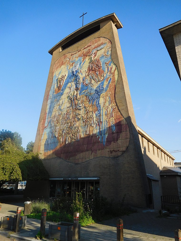
Photo: Grentidez, CC BY-SA 4.0.
Church of St. Martin is situated 200 metres east of Café In den Hemel.
Rivieren Castle
Castle

Photo: Rharris, CC BY-SA 3.0.
Rivieren Castle is a 12th-century castle in Ganshoren, a municipality of Brussels, Belgium. The castle is surrounded by a pond, in a park of 10 hectares : Albert Park. Rivieren Castle is situated 510 metres north of Café In den Hemel.
Places in the Area
Nearby places include Ganshoren and Cité Moderne - Moderne Wijk.
Ganshoren
Town

Photo: Michel wal, CC BY-SA 3.0.
Ganshoren is one of the 19 municipalities of the Brussels-Capital Region, Belgium. Located in the north-western part of the region, it is bordered by Berchem-Sainte-Agathe, Jette, and Koekelberg, as well as the Flemish municipality of Asse.
Cité Moderne - Moderne Wijk
Neighborhood

Photo: Ben2, CC BY-SA 3.0.
Cité Moderne - Moderne Wijk is a neighborhood.
Het Heideken
Neighborhood
Het Heideken is a district of Ganshoren, a municipality of Brussels, Belgium. The housing complex is uniquely shaped like a butterfly or kite and stretches across both sides of Avenue de l'Exposition Universelle/Wereldtentoonstellingslaan.
Café In den Hemel
- Type: Pub
- Location: Ganshoren, Arrondissement of Brussels-Capital, Brussels, Brussels Capital, Belgium, Benelux, Europe
- View on OpenStreetMap
Latitude
50.87215° or 50° 52′ 20″ northLongitude
4.31185° or 4° 18′ 43″ eastOpen location code
9F26V8C6+VPOpenStreetMap ID
node 1260692098OpenStreetMap feature
amenity=pub
This page is based on OpenStreetMap, Wikidata, and Wikimedia Commons.
We’d love your help improving our open data sources. Thank you for contributing.
Satellite Map
Discover Café In den Hemel from above in high-definition satellite imagery.
Notable Places Nearby
Highlights include Commissariat de Ganshoren - Commissariaat Ganshoren and De Werfberg.
Nearby Places
Explore places such as Millenium Pharma and Crèche communale Les Poussins.
Belgium: Must-Visit Destinations
Delve into Brussels, Antwerp, Ghent, and Liège.
Curious Pubs to Discover
Uncover intriguing pubs from every corner of the globe.
About Mapcarta. Data © OpenStreetMap contributors and available under the Open Database License". Text is available under the CC BY-SA 4.0 license, except for photos, directions, and the map. Photo: Hullie, CC BY-SA 3.0.