Summit Cycles
Summit Cycles is a bike shop in Aberystwyth, Ceredigion, Wales. Summit Cycles is situated nearby to the church Capel y Morfa, as well as near Aberystwyth Bus Station.| Tap on a place to explore it |
Places of Interest Nearby
Highlights include Aberystwyth railway station and Ceredigion Museum.
Aberystwyth railway station
Railway station
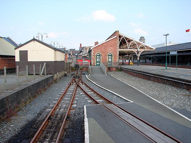
Photo: OLU, CC BY-SA 2.0.
Aberystwyth railway station is located in the town of Aberystwyth, Ceredigion, Wales; it is served by passenger trains operated by Transport for Wales. It is the terminus of both the Cambrian Line and of the narrow-gauge Vale of Rheidol Railway. Aberystwyth railway station is situated 720 feet south of Summit Cycles.
Ceredigion Museum
Museum

Photo: Ian Capper, CC BY-SA 2.0.
Ceredigion Museum is a museum in Aberystwyth, Ceredigion, Wales. Ceredigion Museum is situated 650 feet west of Summit Cycles.
Capel y Morfa
Church

Photo: Stefanik, CC BY-SA 4.0.
Capel y Morfa is a church, which is situated 420 feet northwest of Summit Cycles.
Places in the Area
Nearby places include Penparcau and Waunfawr.
Penparcau
Village

Photo: Llywelyn2000, CC BY-SA 4.0.
Penparcau is a village and electoral ward in Ceredigion, Wales, situated to the south of Aberystwyth. The original village was a hamlet, but the building of extensive Art Deco style semi-detached social housing from the 1920s on transformed it.

Llanbadarn Fawr
Suburb

Photo: OLU, CC BY-SA 2.0.
Llanbadarn Fawr is a village and community in Ceredigion, Wales. It is on the outskirts of Aberystwyth next to Penparcau and Southgate. It forms the eastern part of the continually built-up area of Aberystwyth.
Summit Cycles
- Type: Bike shop
- Category: shop
- Location: Aberystwyth, Ceredigion, Mid Wales, Wales, United Kingdom, Britain and Ireland, Europe
- View on OpenStreetMap
Latitude
52.41583° or 52° 24′ 57″ northLongitude
-4.08093° or 4° 4′ 51″ westOpen location code
9C4QCW89+8JOpenStreetMap ID
node 1270594633OpenStreetMap feature
shop=bicycle
This page is based on OpenStreetMap, Wikidata, and Wikimedia Commons.
We’d love your help improving our open data sources. Thank you for contributing.
Satellite Map
Discover Summit Cycles from above in high-definition satellite imagery.
Places with the Same Name
Discover other places named “Summit Cycles”.
Notable Places Nearby
Highlights include Aberystwyth Bus Station and Queen’s Square.
Nearby Places
Explore places such as North Parade and Premier.
Ceredigion: Must-Visit Destinations
Delve into Cardigan, Aberaeron, Lampeter, and New Quay.
Curious Bike Shops to Discover
Uncover intriguing bike shops from every corner of the globe.
About Mapcarta. Data © OpenStreetMap contributors and available under the Open Database License". Text is available under the CC BY-SA 4.0 license, except for photos, directions, and the map. Photo: Voice of Clam, Public domain.