Q1 Taxi Rank
Q1 Taxi Rank is a taxicab stand in City of Gold Coast, Queensland. Q1 Taxi Rank is situated nearby to Q1 (building), as well as near the scenic viewpoint Skypoint Observaton Deck.| Tap on a place to explore it |
Places of Interest Nearby
Highlights include Q1 (building) and Surfers Paradise light rail station.
Q1 (building)
Building
 Q1 Tower is a 322.5-metre supertall skyscraper in Queensland, Australia. The residential tower on the Gold Coast was the world's tallest residential building from 2005 to 2011.
Surfers Paradise light rail station
Railway station
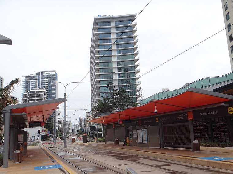
Photo: Wikimedia, CC BY-SA 3.0.
Surfers Paradise light rail station is located on the corner of Clifford St and Surfers Paradise Boulevard. The station is situated centrally of suburb of Surfers Paradise, the key tourist destination in the city of the Gold Coast.
Northcliffe light rail station
Railway station
 Northcliffe light rail station is located on the southern end of Surfers Paradise Blvd on the corner of Thorton St in the suburb of Surfers Paradise, Queensland, Australia, Gold Coast's key tourist destination. Northcliffe light rail station is situated 360 metres south of Q1 Taxi Rank.
Places in the Area
Nearby places include Surfers Paradise and Gold Coast.
Surfers Paradise

Photo: Kgbo, CC BY-SA 4.0.
Surfers Paradise is a suburb of the Gold Coast in Queensland, and one of the largest tourist destinations in Australia. Set on kilometres of ocean surf beach, Surfers has more going on than just the waves.
Gold Coast
 The Gold Coast is a large city along the coast in the southeast corner of the state of Queensland in Australia. The year-round warm weather, theme parks and many beaches just south of Brisbane have made it a popular destination with travellers.
Broadbeach
 Broadbeach is a beachside district in the city of Gold Coast in the south of Queensland in Australia. It is directly to the south of the Surfers Paradise suburb. This Wikivoyage article covers the suburbs of Broadbeach and Broadbeach Waters.
Q1 Taxi Rank
- Type: Taxicab stand
- Category: transportation
- Location: City of Gold Coast, Queensland, Australia, Oceania
- View on OpenStreetMap
Latitude
-28.00679° or 28° 0′ 24″ southLongitude
153.42969° or 153° 25′ 47″ eastOpen location code
5R3MXCVH+7VOpenStreetMap ID
node 1278125928OpenStreetMap feature
amenity=taxi
This page is based on OpenStreetMap, Wikidata, and Wikimedia Commons.
We’d love your help improving our open data sources. Thank you for contributing.
Satellite Map
Discover Q1 Taxi Rank from above in high-definition satellite imagery.
Notable Places Nearby
Highlights include Skypoint Observaton Deck and St. Vincent’s Catholic Church.
Nearby Places
Explore places such as Asami Teppanyaki and Gold Coast Hostel.
Queensland: Must-Visit Destinations
Delve into Brisbane, Gold Coast, Sunshine Coast, and Cairns.
Curious Taxicab Stands to Discover
Uncover intriguing taxicab stands from every corner of the globe.
About Mapcarta. Data © OpenStreetMap contributors and available under the Open Database License". Text is available under the CC BY-SA 4.0 license, except for photos, directions, and the map. Photo: Wikimedia, CC0.