Camino Real Bell
Camino Real Bell is a memorial in Santa Barbara County, Central Coast, California. Camino Real Bell is situated nearby to the park Campo Santo, as well as near the church Iglesia de Santa Inés.| Tap on a place to explore it |
Places of Interest Nearby
Highlights include Mission Santa Inés and Solvang Vintage Motorcycle Museum.
Mission Santa Inés
Museum
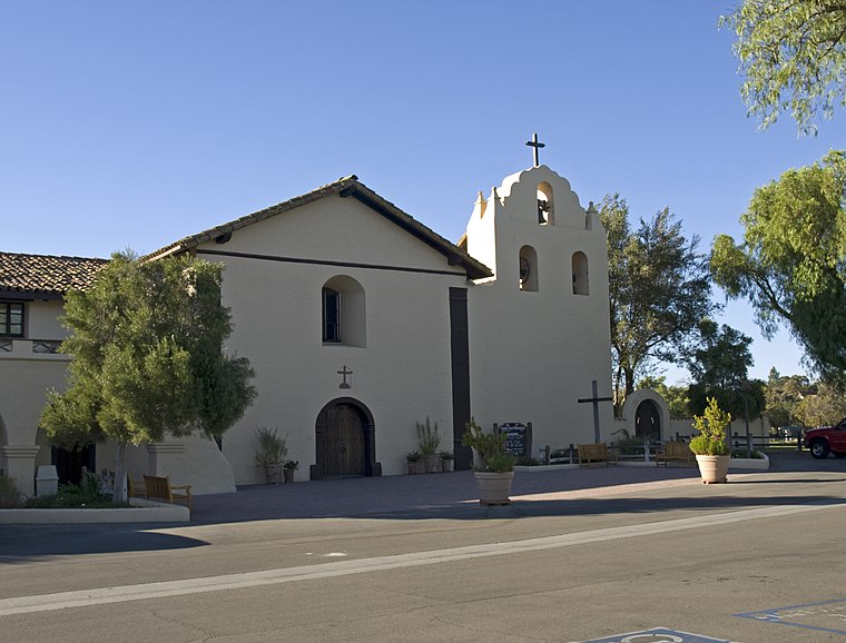
Photo: Ymblanter, CC BY-SA 4.0.
Mission Santa Inés was a Spanish mission in present-day Solvang, California, United States, and named after St. Agnes of Rome. Founded on September 17, 1804, by Father Estévan Tapís of the Franciscan order, the mission site was chosen as a midway point…
Solvang Vintage Motorcycle Museum
Museum
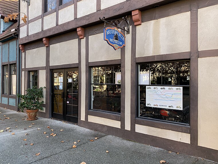
Photo: DocFreeman24, CC BY-SA 4.0.
The Solvang Vintage Motorcycle Museum is a 'Collector's Collection' museum in Solvang, California, United States. The museum was founded in March 2000 by Virgil Elings, a local retiree and a collector of motorcycles. Solvang Vintage Motorcycle Museum is situated 1,500 feet southwest of Camino Real Bell.
Solvang Festival Theater
Theater building
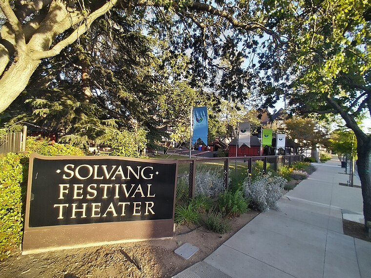
Photo: Sankeytm, CC BY-SA 4.0.
Solvang Festival Theater is a theater building, which is situated 1,400 feet west of Camino Real Bell.
Places in the Area
Nearby places include Solvang and Ballard.
Solvang

Photo: Annette Teng, CC BY 3.0.
Solvang is in the Santa Ynez Valley of Santa Barbara County in Southern California. The city is Danish-themed as if it were the Danishland section of Disneyland, since it was founded by Danish immigrants and quite a few Danish descendants live here.
Ballard
Village
Ballard is an unincorporated community in Santa Barbara County, California. Ballard is the smallest and oldest community in the Santa Ynez Valley. The nearest city is Solvang. Ballard is situated 3 miles northeast of Camino Real Bell.
Santa Ynez

Photo: Thomas Camargo, CC BY 3.0.
Santa Ynez is a small community in the Santa Ynez Valley winery region of Santa Barbara County in Southern California. It's in a valley of small towns, rolling hills, majestic oaks and friendly people.
Camino Real Bell
- Type: Memorial
- Category: historic site
- Location: Santa Barbara County, Central Coast, California, United States, North America
- View on OpenStreetMap
Latitude
34.59478° or 34° 35′ 41″ northLongitude
-120.13627° or 120° 8′ 11″ westOpen location code
846XHVV7+WFOpenStreetMap ID
node 12825446592OpenStreetMap feature
historic=memorial
This page is based on OpenStreetMap, Wikidata, and Wikimedia Commons.
We’d love your help improving our open data sources. Thank you for contributing.
Satellite Map
Discover Camino Real Bell from above in high-definition satellite imagery.
Notable Places Nearby
Highlights include Campo Santo and Iglesia de Santa Inés.
Nearby Places
Explore places such as Campo Santo and Junípero Serra.
Santa Barbara County: Must-Visit Destinations
Delve into Santa Barbara, Santa Maria, Solvang, and Carpinteria.
Curious Memorials to Discover
Uncover intriguing memorials from every corner of the globe.
About Mapcarta. Data © OpenStreetMap contributors and available under the Open Database License". Text is available under the CC BY-SA 4.0 license, except for photos, directions, and the map. Photo: Wikimedia, CC0.