Vallance By-ways
Vallance By-ways is a dwelling in Charlwood, Mole Valley, England. Vallance By-ways is situated nearby to Spicer’s Bridge, as well as near Gatwick Aviation Museum.| Tap on a place to explore it |
Places of Interest Nearby
Highlights include Gatwick Airport and Gatwick Aviation Museum.
Gatwick Airport
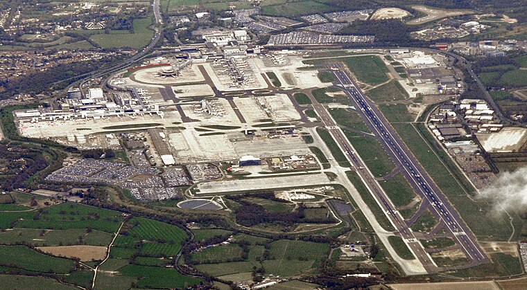
Photo: Mike McBey, CC BY 2.0.
Gatwick Airport is London's second-busiest airport by passenger numbers, and serves the south-east of the United Kingdom. It is a hub for British Airways, easyJet and TUI Airways.
Gatwick Aviation Museum
Museum

Photo: MilborneOne, CC BY-SA 4.0.
The Gatwick Aviation Museum is located in the village of Charlwood, in Surrey, United Kingdom on the boundary of Gatwick Airport. Gatwick Aviation Museum is situated 400 feet southeast of Vallance By-ways.
Providence Chapel
Church

Photo: The Voice of Hassocks, CC0.
Providence Chapel is a former Nonconformist place of worship in the village of Charlwood in Surrey, England. Founded in 1816 on the outskirts of the ancient village, it was associated with Independent Calvinists and Strict Baptists throughout nearly two centuries of religious use. Providence Chapel is situated 1,500 feet north of Vallance By-ways.
Places in the Area
Nearby places include Lowfield Heath and Langley Green.
Lowfield Heath
Suburb

Photo: The Voice of Hassocks, Public domain.
Lowfield Heath is a former village within the boundaries of the Borough of Crawley, West Sussex, England. Situated on the main London to Brighton road approximately 27 miles south of London and 2 miles north of Crawley, it was gradually rendered uninhabitable by the expansion of London Gatwick Airport immediately to the north. Lowfield Heath is situated 1½ miles east of Vallance By-ways.
Langley Green
Village

Photo: The Voice of Hassocks, Public domain.
Langley Green is a one of 14 neighbourhoods within the town of Crawley in West Sussex, England. Langley Green is in the north-west of the town and is bordered by Manor Royal to the east, Northgate to the south east, West Green to the south across the ring road and Ifield to the west. Langley Green is situated 2 miles southeast of Vallance By-ways.
Ifield
Village

Photo: Stuart Johnson, CC BY-SA 2.0.
Ifield is a former village and now one of 14 neighbourhoods within the town of Crawley in West Sussex, England. Ifield is in the west of the town and is bordered by Ifield West, Horsham, Langley Green to the north east, West Green to the east across the ring road and Gossops Green and Bewbush to the south across the Arun Valley railway line. Ifield is situated 2 miles south of Vallance By-ways.
Vallance By-ways
- Type: Dwelling
- Categories: locality, residential building, and building
- Location: Charlwood, Mole Valley, Surrey, South East England, England, United Kingdom, Britain and Ireland, Europe
- View on OpenStreetMap
Latitude
51.15301° or 51° 9′ 11″ northLongitude
-0.21657° or 0° 12′ 60″ westOpen location code
9C3X5Q3M+69OpenStreetMap ID
node 12863068558OpenStreetMap feature
place=isolated_dwelling
This page is based on OpenStreetMap, Wikidata, and Wikimedia Commons.
We’d love your help improving our open data sources. Thank you for contributing.
Satellite Map
Discover Vallance By-ways from above in high-definition satellite imagery.
Notable Places Nearby
Highlights include Spicer’s Bridge and Vallance Byways.
Nearby Places
Explore places such as Charlwood Place Farm and The Greyhound.
Surrey: Must-Visit Destinations
Delve into Guildford, Woking, Godalming, and Epsom.
Curious Dwellings to Discover
Uncover intriguing dwellings from every corner of the globe.
About Mapcarta. Data © OpenStreetMap contributors and available under the Open Database License". Text is available under the CC BY-SA 4.0 license, except for photos, directions, and the map. Photo: Wikimedia, CC0.