Tŷ Draw Farm Airstrip
Tŷ Draw Farm Airstrip is a pitch in St Georges-super-Ely, Vale of Glamorgan, Wales. Tŷ Draw Farm Airstrip is situated nearby to the forest Gwern Rhyd, as well as near Castle Wood.| Tap on a place to explore it |
Places of Interest Nearby
Highlights include St Fagans National Museum of History and St Teilo’s Church.
St Fagans National Museum of History
Park
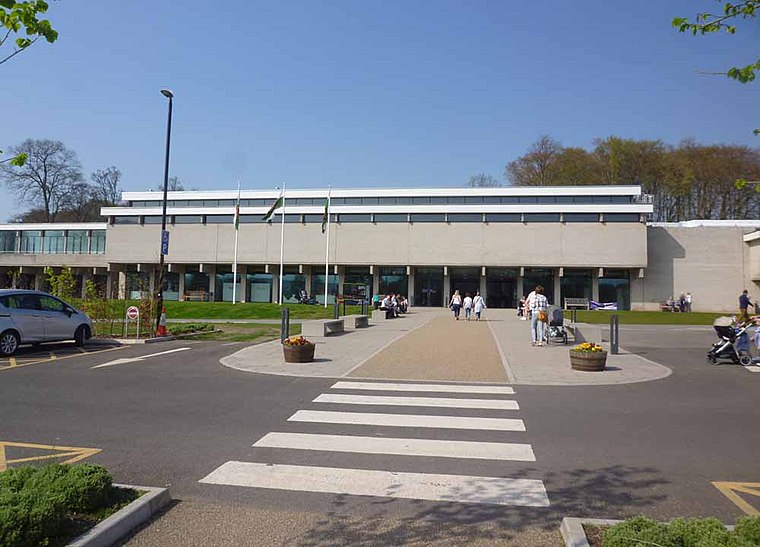
Photo: Sionk, CC BY-SA 4.0.
St Fagans National Museum of History, commonly referred to as St Fagans after the village where it is located, is an open-air museum in St Fagans, Cardiff, Wales, chronicling the historical lifestyle, culture, and architecture of the Welsh people. St Fagans National Museum of History is situated 1 mile east of Tŷ Draw Farm Airstrip.
St Teilo’s Church
Museum

Photo: Adrian Platt, CC BY-SA 2.0.
St Teilo's Church is a historic building originally located at Llandeilo Tal-y-Bont near Pontarddulais and now reconstructed at St Fagans National History Museum in Cardiff, Wales. St Teilo’s Church is situated 3,300 feet east of Tŷ Draw Farm Airstrip.
Oakdale Workmen’s Institute
Museum

Photo: Immanuel Giel, Public domain.
Oakdale Workmen's Institute is a public building originally erected at Oakdale, Caerphilly, Wales, in 1917 and now located at St Fagans National Museum of History, Cardiff. Oakdale Workmen’s Institute is situated 3,700 feet east of Tŷ Draw Farm Airstrip.
Places in the Area
Nearby places include St Brides-super-Ely and Peterston-Super-Ely.
St Brides-super-Ely
Hamlet

Photo: Alan Hughes, CC BY-SA 2.0.
St Brides-super-Ely is a village and district of the community of St Georges-super-Ely, within the Vale of Glamorgan in South Wales. It is located near the western border of the Welsh capital city of Cardiff, to the west of the A4232, and north of the River Ely.
Peterston-Super-Ely
Village

Photo: Gareth James, CC BY-SA 2.0.
Cowbridge is a market town in the Vale of Glamorgan, between Cardiff and Bridgend. It is set in the countryside, about 15 minutes' drive from the Glamorgan Heritage Coast.
Gwern-y-Steeple
Hamlet

Photo: Mick Lobb, CC BY-SA 2.0.
Gwern-y-steeple is a hamlet in the Vale of Glamorgan, Wales. It lies north of the A48 road and north-west St. Nicholas on the road south-west of Peterston-Super-Ely. Gwern-y-Steeple is situated 2 miles southwest of Tŷ Draw Farm Airstrip.
Tŷ Draw Farm Airstrip
- Type: Pitch
- Categories: recreation area, model airport, and sports location
- Location: St Georges-super-Ely, Vale of Glamorgan, Wales, United Kingdom, Britain and Ireland, Europe
- View on OpenStreetMap
Latitude
51.4853° or 51° 29′ 7″ northLongitude
-3.29411° or 3° 17′ 39″ westInception
April 2018Operator
Cardiff Model Aircraft ClubOpen location code
9C3RFPP4+49OpenStreetMap ID
node 12961358103OpenStreetMap feature
leisure=pitchOpenStreetMap feature
sport=model_aerodrome
This page is based on OpenStreetMap, Wikidata, and Wikimedia Commons.
We’d love your help improving our open data sources. Thank you for contributing.
Satellite Map
Discover Tŷ Draw Farm Airstrip from above in high-definition satellite imagery.
Notable Places Nearby
Highlights include Gwern Rhyd and Castle Wood.
Nearby Places
Explore places such as Morlanga Primary Substation and Gweithdy Cafe.
Wales: Must-Visit Destinations
Delve into Cardiff, Swansea, Newport, and Llanfairpwllgwyngyll.
Curious Pitches to Discover
Uncover intriguing pitches from every corner of the globe.
About Mapcarta. Data © OpenStreetMap contributors and available under the Open Database License". Text is available under the CC BY-SA 4.0 license, except for photos, directions, and the map. Photo: fionamcallisterphotography, CC BY 2.0.