Michael Skjelderup (1769–1852)
Michael Skjelderup (1769–1852) is a work of art in Oslo Municipality, Oslo, Innlandet. Michael Skjelderup (1769–1852) is situated nearby to the church Vår Frelsers ortodokse kirke, as well as near Kapellet St. Sunniva skole.| Tap on a place to explore it |
Places of Interest Nearby
Highlights include St. Olav’s Cathedral and Cemetery of Our Saviour.
St. Olav’s Cathedral
Church
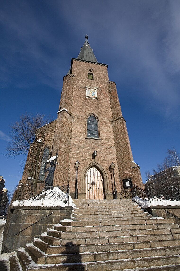
Photo: AsgeirM, CC BY-SA 3.0.
St. Olav's Cathedral is the cathedral of the Roman Catholic Diocese of Oslo and the parish church of St. Olav's parish in Oslo, Norway. The cathedral has church services and masses in Norwegian and several other languages, including English and Polish. St. Olav’s Cathedral is situated 200 metres southwest of Michael Skjelderup (1769–1852).
Cemetery of Our Saviour
Cemetery

Photo: Mahlum, Public domain.
The Cemetery of Our Saviour is a cemetery in Oslo, Norway, located north of Hammersborg in Gamle Aker district. It is located adjacent to the older Old Aker Cemetery and was created in 1808 as a result of the great famine and cholera epidemic of the Napoleonic Wars. Cemetery of Our Saviour is situated 180 metres northwest of Michael Skjelderup (1769–1852).
National Gallery
Public building

Photo: Bep, CC BY-SA 3.0.
The National Gallery is a gallery in Oslo, Norway. Since 2003 it is administratively a part of the National Museum of Art, Architecture and Design. National Gallery is situated 630 metres southwest of Michael Skjelderup (1769–1852).
Places in the Area
Nearby places include Fredensborg and Gamle Aker.

Regjeringskvartalet
Neighborhood

Photo: Paalso, CC BY-SA 3.0.
Regjeringskvartalet is a collection of buildings located in the centre of Norway's capital city Oslo, housing several offices for the Norwegian Government.
Michael Skjelderup (1769–1852)
- Type: Work of art
- Category: tourism
- Location: Oslo Municipality, Oslo, Oslo region, East Norway, Alvdal, Innlandet, Norway, Nordic countries, Europe
- View on OpenStreetMap
Latitude
59.92001° or 59° 55′ 12″ northLongitude
10.74582° or 10° 44′ 45″ eastOpen location code
9FFGWPCW+28OpenStreetMap ID
node 12974397869OpenStreetMap feature
tourism=artwork
This page is based on OpenStreetMap, Wikidata, and Wikimedia Commons.
We’d love your help improving our open data sources. Thank you for contributing.
Satellite Map
Discover Michael Skjelderup (1769–1852) from above in high-definition satellite imagery.
Notable Places Nearby
Highlights include Vår Frelsers ortodokse kirke and Kapellet St. Sunniva skole.
Nearby Places
Explore places such as Bjarne Hjorth;Ragnhild Hjorth;Solveig Lund;Josefine Nielsen;Margot Hiortashttps://photos.app.goo.gl/bQquYq5b3sEBFcTB6 and Gina Krog (1847-1916).
Oslo: Must-Visit Destinations
Delve into Sentrum, North Oslo, Inner North, and Inner East.
Curious Work Of Arts to Discover
Uncover intriguing work of arts from every corner of the globe.
About Mapcarta. Data © OpenStreetMap contributors and available under the Open Database License". Text is available under the CC BY-SA 4.0 license, except for photos, directions, and the map. Photo: Krakers, CC BY-SA 4.0.