Capolinea AMT
Capolinea AMT is a bus station in Montoggio, Province of Genoa, Liguria. Capolinea AMT is situated nearby to the peak Monte Acuto, as well as near Monte Moro.| Tap on a place to explore it |
Places of Interest Nearby
Highlights include Monte Bano and Fieschi Castle.
Monte Bano
Peak
Monte Bano is a mountain in Liguria, northern Italy, part of the Ligurian Apennines. It is located in the province of Genoa. It lies at an altitude of 1035 metres.
Fieschi Castle
Ruins

Photo: Paolocarminati81, CC BY-SA 4.0.
Fieschi Castle is a ruins, which is situated 2 km west of Capolinea AMT.
Lago di Val di Noci
Reservoir

Photo: Roger469, CC BY-SA 3.0.
Lago di Val di Noci is a lake in the Province of Genova, Liguria, Italy. Lago di Val di Noci is situated 3 km southwest of Capolinea AMT.
Places in the Area
Nearby places include Montoggio and Davagna.
Montoggio
Village

Photo: Dapa19, CC BY-SA 4.0.
Montoggio is a comune in the Metropolitan City of Genoa in the Italian region Liguria, located about 14 kilometres northeast of Genoa. As of October 2006, it had a population of 2,018 and an area of 46.4 square kilometres.
Davagna
Village
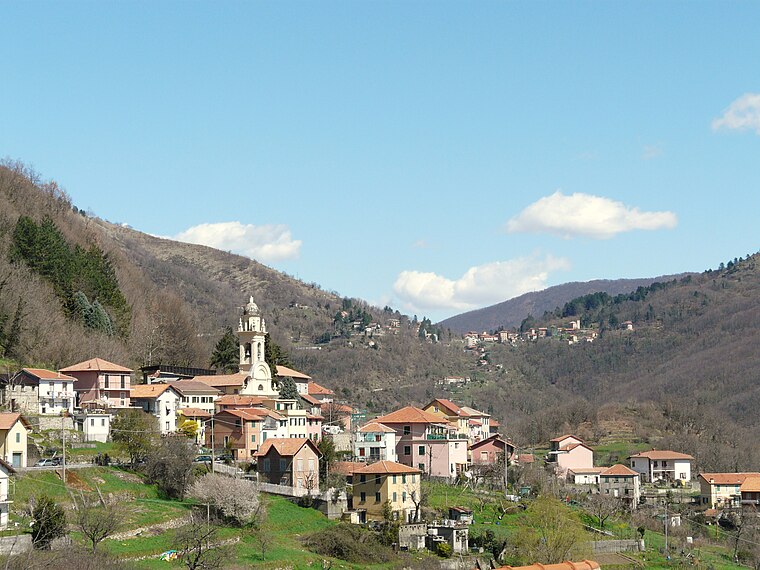
Photo: Wikimedia, CC BY-SA 3.0.
Davagna is a comune in the Metropolitan City of Genoa in the Italian region Liguria, located about 13 kilometres northeast of Genoa. The municipality of Davagna borders the following municipalities: Bargagli, Genoa, Lumarzo, Montoggio and Torriglia. Davagna is situated 6 km south of Capolinea AMT.
Marsiglia
Hamlet

Photo: Cosmin latan, CC BY-SA 3.0.
Marsiglia is an Italian village and hamlet of the municipality of Davagna in the Province of Genoa, Liguria. As of 2009 its population was of 55. Marsiglia is situated 6 km south of Capolinea AMT.
Capolinea AMT
- Type: Bus station
- Categories: station and transportation
- Location: Montoggio, Province of Genoa, Liguria, Northwest Italy, Italy, Europe
- View on OpenStreetMap
Latitude
44.51378° or 44° 30′ 50″ northLongitude
9.06598° or 9° 3′ 58″ eastOpen location code
8FPFG378+G9OpenStreetMap ID
node 12993956483OpenStreetMap feature
amenity=bus_stationOpenStreetMap feature
public_transport=station
This page is based on OpenStreetMap, Wikidata, and Wikimedia Commons.
We’d love your help improving our open data sources. Thank you for contributing.
Satellite Map
Discover Capolinea AMT from above in high-definition satellite imagery.
Notable Places Nearby
Highlights include Monte Acuto and Croce Rossa - Montoggio -.
Nearby Places
Explore places such as Da Victoria - Trattoria Pizzeria and Albergo Da Alfredo.
Liguria: Must-Visit Destinations
Delve into Genoa, Sanremo, La Spezia, and Savona.
Curious Bus Stations to Discover
Uncover intriguing bus stations from every corner of the globe.
About Mapcarta. Data © OpenStreetMap contributors and available under the Open Database License". Text is available under the CC BY-SA 4.0 license, except for photos, directions, and the map. Photo: Yoggysot, CC BY-SA 3.0.