Manning Reef
Manning Reef is a reef in Tasmania, Australia. Manning Reef is situated nearby to the park Maning Reef Reserve, as well as near Red Chapel Beach.| Tap on a place to explore it |
Places of Interest Nearby
Highlights include Nutgrove Beach and Queenborough Oval.
Nutgrove Beach
Beach
Nutgrove Beach is a popular beach destination along the River Derwent in Sandy Bay, Hobart, Tasmania. The north facing beach has views of Mount Wellington, Lords Beach, Wrest Point Hotel Casino, the Tasman Bridge, and the City of Clarence on the eastern shore.
Queenborough Oval
Pitch

Photo: Forfuxake, CC BY-SA 3.0.
Queenborough Oval is the home headquarters of the Hutchins Old Boys Football Club and the South Hobart/Sandy Bay Cricket Club. The ground is a former Tasmanian Football League venue, being the former home of the Sandy Bay Football Club from 1945 to 1997. Queenborough Oval is situated 1 km west of Manning Reef.
Long Beach
Beach
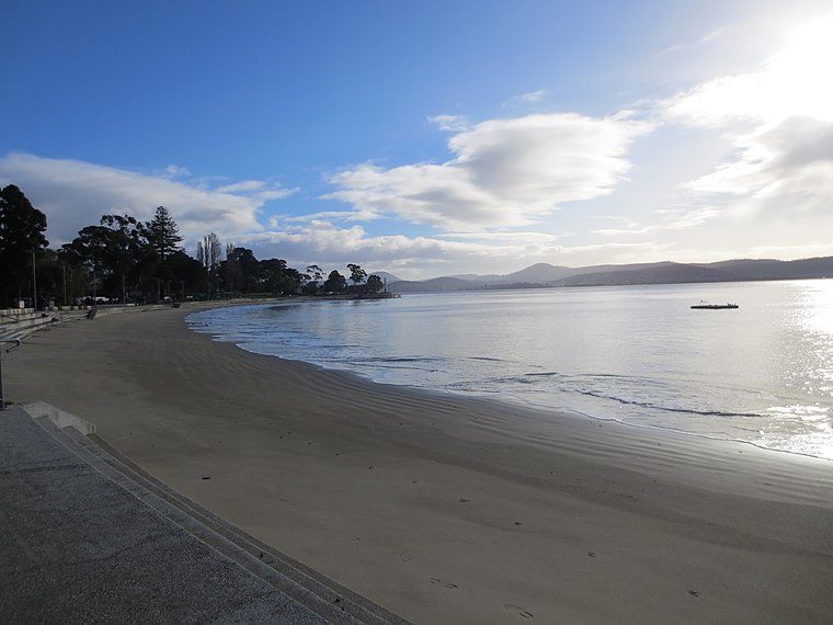
Photo: Spaceboy56, CC BY-SA 4.0.
Long Beach is a popular beach destination along the River Derwent in Sandy Bay, Hobart, Tasmania. The east facing beach has views of the City of Clarence on the eastern shore and Blinking Billy Point.
Places in the Area
Nearby places include Sandy Bay and Battery Point.
Sandy Bay
Suburb
Sandy Bay is a suburb of Hobart, Tasmania, Australia, situated immediately south of the city's central business district and adjoining Battery Point. Bordered to the east by the River Derwent, Sandy Bay is known for its waterfront location and popular beaches, including Nutgrove Beach, Long Beach, and Lords Beach.
Battery Point
Suburb

Photo: StAnselm, Public domain.
Battery Point is a suburb of the city of Hobart, Tasmania, Australia. It is immediately south of the central business district. It is in the local government area of City of Hobart.
Mount Nelson
Suburb
Mount Nelson is a residential suburb of Hobart, Tasmania, located approximately 4 km south of the Hobart city centre. It is part of both the City of Hobart and Kingborough Council municipalities. Mount Nelson is situated 2½ km southwest of Manning Reef.
Manning Reef
Latitude
-42.9065° or 42° 54′ 23″ southLongitude
147.34369° or 147° 20′ 37″ eastOpen location code
4R9938VV+CFOpenStreetMap ID
node 13051482068OpenStreetMap feature
natural=reef
This page is based on OpenStreetMap, Wikidata, and Wikimedia Commons.
We’d love your help improving our open data sources. Thank you for contributing.
Satellite Map
Discover Manning Reef from above in high-definition satellite imagery.
Places with the Same Name
Discover other places named “Manning Reef”.
Notable Places Nearby
Highlights include Maning Reef Reserve and Red Chapel Beach.
Nearby Places
Explore places such as Maning Reef and Sandy Bay Rd Stop 13 Out.
Tasmania: Must-Visit Destinations
Delve into Hobart, Bass Strait Islands, Launceston, and Arthur-Pieman Conservation Area.
Curious Reefs to Discover
Uncover intriguing reefs from every corner of the globe.
About Mapcarta. Data © OpenStreetMap contributors and available under the Open Database License". Text is available under the CC BY-SA 4.0 license, except for photos, directions, and the map. Photo: Wikimedia, CC0.