Thurles River Walk Biodiversity
Thurles River Walk Biodiversity is in County Tipperary, Munster. Thurles River Walk Biodiversity is situated nearby to the shopping center Thurles Shopping Centre, as well as near Thurles Post Office.| Tap on a place to explore it |
Places of Interest Nearby
Highlights include Thurles and Cathedral of the Assumption, Thurles.
Thurles
Railway station
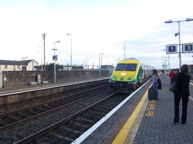
Photo: Brian Shaw, CC BY-SA 2.0.
Thurles railway station serves the town of Thurles in County Tipperary in Ireland. The station is on the Dublin–Cork Main line, and is situated 86.5 miles from Dublin Heuston. Thurles is situated 1 km northwest of Thurles River Walk Biodiversity.
Cathedral of the Assumption, Thurles
Church

Photo: JohnArmagh, Public domain.
The Cathedral of the Assumption is the mother church of the Metropolitan Province of Cashel and the cathedral church of the Roman Catholic Archdiocese of Cashel and Emly in Thurles, County Tipperary in Ireland. Cathedral of the Assumption, Thurles is situated 1 km north of Thurles River Walk Biodiversity.
Semple Stadium
Stadium
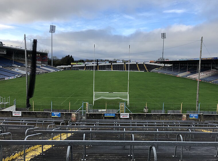
Photo: DaHuzyBru, CC BY-SA 4.0.
FBD Semple Stadium is the home of hurling and Gaelic football for Tipperary GAA and for the province of Munster. Located in Thurles, County Tipperary, it is the second largest GAA stadium in Ireland, with a capacity of 45,690 and named after Tom Semple, the captain of the Thurles "Blues". Semple Stadium is situated 1½ km northwest of Thurles River Walk Biodiversity.
Places in the Area
Nearby places include Thurles and Holycross.
Thurles
Thurles is a market town in County Tipperary, with a population of 8200 in 2022. In Irish it's Durlas Éile, "strong fort of the Éile", a tribe or small kingdom that reached its zenith in the 5th century AD.Holycross
Village

Photo: Sarah777, Public domain.
Thurles is a market town in County Tipperary, with a population of 8200 in 2022. In Irish it's Durlas Éile, "strong fort of the Éile", a tribe or small kingdom that reached its zenith in the 5th century AD. Holycross is situated 5 km southwest of Thurles River Walk Biodiversity.
Moycarkey
Village
Moycarkey, sometimes written Moycarky, is a village at the northern end of Moycarky townland in the civil parish of Moycarky in County Tipperary, Ireland. Moycarkey is situated 5 km south of Thurles River Walk Biodiversity.
Thurles River Walk Biodiversity
- Type: Sign
- Categories: information and tourism
- Location: County Tipperary, Munster, Shannon Region, Ireland, Britain and Ireland, Europe
- View on OpenStreetMap
Latitude
52.67237° or 52° 40′ 21″ northLongitude
-7.81164° or 7° 48′ 42″ westOperator
Tipperary County CouncilOpen location code
9C4JM5CQ+W8OpenStreetMap ID
node 13200480063OpenStreetMap feature
tourism=information
This page is based on OpenStreetMap, Wikidata, and Wikimedia Commons.
We’d love your help improving our open data sources. Thank you for contributing.
Satellite Map
Discover Thurles River Walk Biodiversity from above in high-definition satellite imagery.
Notable Places Nearby
Highlights include Thurles Shopping Centre and Thurles Post Office.
Nearby Places
Explore places such as Complete Foot Care Clinic and Insomnia.
County Tipperary: Must-Visit Destinations
Delve into Clonmel, Nenagh, Tipperary, and Cashel.
Curious Places to Discover
Uncover intriguing places from every corner of the globe.
About Mapcarta. Data © OpenStreetMap contributors and available under the Open Database License". Text is available under the CC BY-SA 4.0 license, except for photos, directions, and the map. Photo: Wikimedia, CC BY-SA 3.0.