Postbasis Bruck / Leitha
Postbasis Bruck / Leitha is a sorting office in Lower Austria, Austria which is located on Eco-Plus Park 5.Straße. Postbasis Bruck / Leitha is situated nearby to ESV Teichschützen Bruck/Leitha, as well as near the motorhome stopover Camping Harrachpark.| Tap on a place to explore it |
Places of Interest Nearby
Highlights include Fire station in Bruck an der Leitha and Schloß Prugg.
Fire station in Bruck an der Leitha
Fire station

Photo: Wikimedia, CC BY-SA 4.0.
Fire station in Bruck an der Leitha is situated 780 metres southwest of Postbasis Bruck / Leitha.
Schloß Prugg
Castle

Photo: Bwag, CC BY-SA 4.0.
Schloß Prugg is a castle, which is situated 1½ km southwest of Postbasis Bruck / Leitha.
Saint Matthew church in Bruck an der Leitha
Church

Photo: Bwag, CC BY-SA 4.0.
Saint Matthew church in Bruck an der Leitha is situated 1½ km southwest of Postbasis Bruck / Leitha.
Places in the Area
Nearby places include Höflein and Rohrau.
Höflein
Village
Höflein is a town in the district of Bruck an der Leitha in Lower Austria in Austria. Höflein is situated 4 km north of Postbasis Bruck / Leitha.
Rohrau
Village
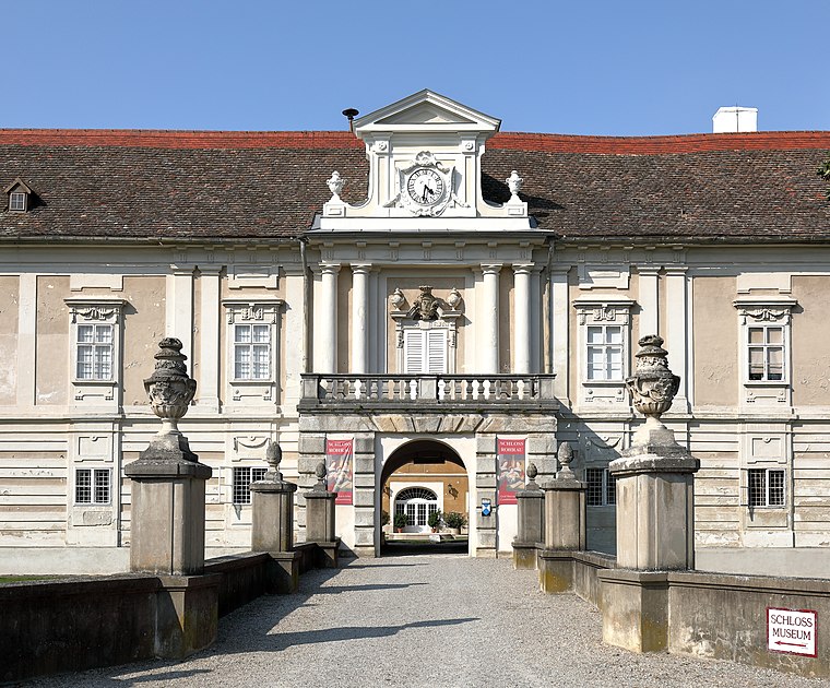
Photo: Bwag, CC BY-SA 4.0.
Rohrau is a village in the state of Lower Austria. The name comes from two German words: Rohr and Au. South of the village is a riparian forest and a swamp covered with reed. Rohrau is situated 6 km northeast of Postbasis Bruck / Leitha.
Scharndorf
Village
Scharndorf is a town in the district of Bruck an der Leitha in Lower Austria in Austria. Scharndorf is situated 7 km north of Postbasis Bruck / Leitha.
Postbasis Bruck / Leitha
- Type: Sorting office
- Address: Eco-Plus Park 5.Straße, Bruck an der Leitha, 2460
- Location: Lower Austria, Austria, Central Europe, Europe
- View on OpenStreetMap
Latitude
48.03407° or 48° 2′ 3″ northLongitude
16.79711° or 16° 47′ 50″ eastOpen location code
8FWR2QMW+JROpenStreetMap ID
node 13294728994OpenStreetMap feature
amenity=post_depot
This page is based on OpenStreetMap, Wikidata, and Wikimedia Commons.
We’d love your help improving our open data sources. Thank you for contributing.
Satellite Map
Discover Postbasis Bruck / Leitha from above in high-definition satellite imagery.
Notable Places Nearby
Highlights include ESV Teichschützen Bruck/Leitha and Camping Harrachpark.
Nearby Places
Explore places such as Celairion GmbH and ROOF HOLZBAU.
Lower Austria: Must-Visit Destinations
Delve into St. Pölten, Wiener Neustadt, Amstetten, and Klosterneuburg.
Curious Sorting Offices to Discover
Uncover intriguing sorting offices from every corner of the globe.
About Mapcarta. Data © OpenStreetMap contributors and available under the Open Database License". Text is available under the CC BY-SA 4.0 license, except for photos, directions, and the map. Photo: Lonezor, CC BY-SA 3.0.