Esch/Alzette, rue Marcelle Dauphin
Esch/Alzette, rue Marcelle Dauphin is a bus stop in Esch-sur-Alzette, Luxembourg. Esch/Alzette, rue Marcelle Dauphin is situated nearby to the government office Société Nationale de Circulation Automobile, as well as near the square Place Adeline Pellegrino.| Tap on a place to explore it |
Places of Interest Nearby
Highlights include Lycée Hubert Clément and Rockhal.
Lycée Hubert Clément
School

Photo: Zinneke, CC BY-SA 3.0.
Lycée Hubert Clément, abbreviated to LHCE, is a high school in Esch-sur-Alzette, in south-western Luxembourg. It was founded as a single-sex girls school in 1955, paralleling Esch's all-boys school, Lycée de Garçons Esch-sur-Alzette, and was named Lycée de Jeunes Filles à Esch-sur-Alzette. Lycée Hubert Clément is situated 1 km southeast of Esch/Alzette, rue Marcelle Dauphin.
Rockhal
Theater building

Photo: Cornischong, CC BY-SA 1.0.
The Rockhal, officially Centre de Musiques Amplifiées, is a concert hall in Esch-sur-Alzette, in southern Luxembourg. It opened on 23 September 2005, has a maximum capacity of 6,500 people and is sited on the former industrial site of Belval in the west of Esch. Rockhal is situated 2 km southwest of Esch/Alzette, rue Marcelle Dauphin.
Saint Henri Church of Esch-sur-Alzette
Church
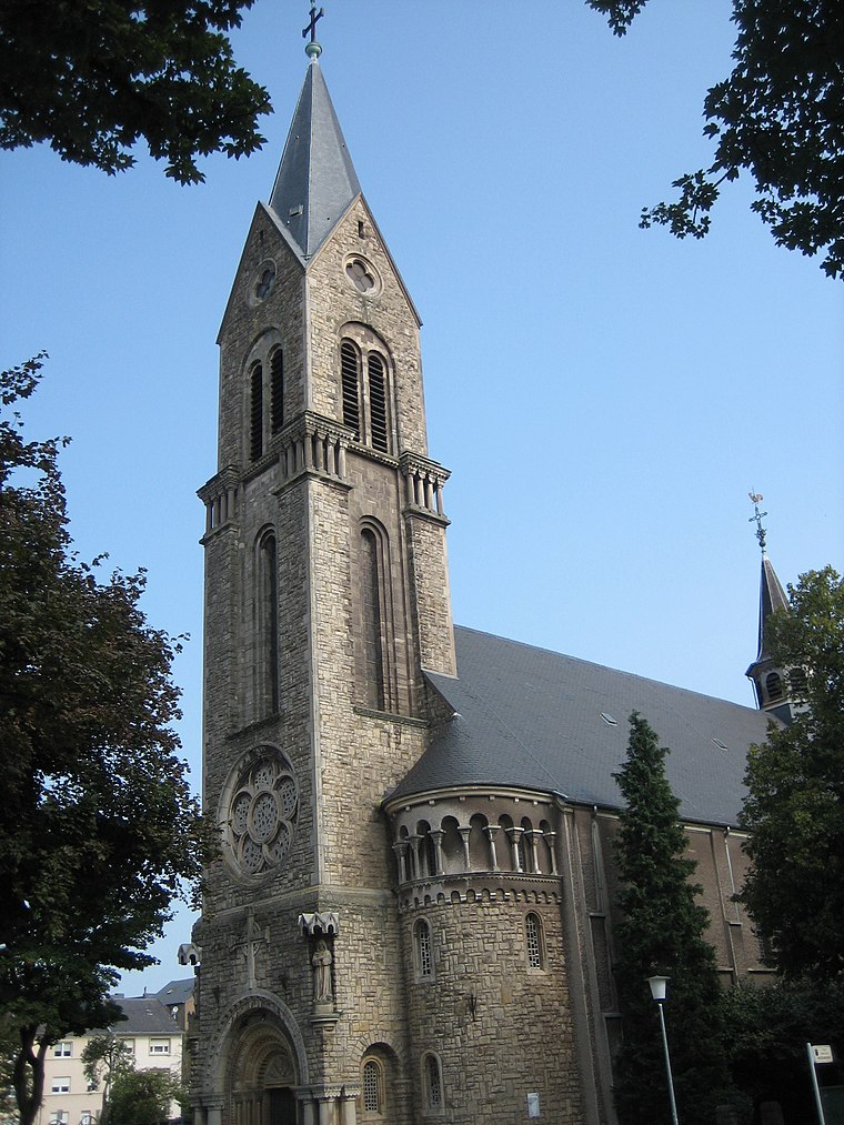
Photo: Zinneke, CC BY-SA 3.0.
Saint Henri Church of Esch-sur-Alzette is situated 1 km southeast of Esch/Alzette, rue Marcelle Dauphin.
Places in the Area
Nearby places include Land of the Red Rocks and Esch-sur-Alzette.
Land of the Red Rocks
The Land of the Red Rocks, also known as the Esch-sur-Alzette canton, is the southwestmost region of Luxembourg.Esch-sur-Alzette
Town

Photo: Zinneke, CC BY-SA 4.0.
The Land of the Red Rocks, also known as the Esch-sur-Alzette canton, is the southwestmost region of Luxembourg.
Ehlerange
Village

Photo: Pecalux, CC BY-SA 3.0 lu.
Ehlerange is a small town in the commune of Sanem, in south-western Luxembourg. As of 2025, the town has a population of 999.
Esch/Alzette, rue Marcelle Dauphin
- Type: Bus stop
- Category: transportation
- Location: Esch-sur-Alzette, Luxembourg, Benelux, Europe
- View on OpenStreetMap
Latitude
49.50814° or 49° 30′ 29″ northLongitude
5.97022° or 5° 58′ 13″ eastOpen location code
8FX7GX5C+73OpenStreetMap ID
node 13316391797OpenStreetMap feature
highway=bus_stopOpenStreetMap feature
public_transport=platform
This page is based on OpenStreetMap, Wikidata, and Wikimedia Commons.
We’d love your help improving our open data sources. Thank you for contributing.
Satellite Map
Discover Esch/Alzette, rue Marcelle Dauphin from above in high-definition satellite imagery.
Notable Places Nearby
Highlights include Société Nationale de Circulation Automobile and Place Adeline Pellegrino.
Nearby Places
Explore places such as Esch/Alzette, rue Marcelle Dauphin and Esch/Alzette, rue d’Ehlerange.
Luxembourg: Must-Visit Destinations
Delve into Luxembourg, Central Luxembourg, Schengen, and Echternach.
Curious Bus Stops to Discover
Uncover intriguing bus stops from every corner of the globe.
About Mapcarta. Data © OpenStreetMap contributors and available under the Open Database License". Text is available under the CC BY-SA 4.0 license, except for photos, directions, and the map. Photo: Michal Osmenda, CC BY-SA 2.0.