Baisse du Clot Aut
Baisse du Clot Aut is a mountain saddle in Valdieri, Province of Cuneo, Piedmont and has an elevation of 2,926 metres. Baisse du Clot Aut is situated nearby to the locality Valle di Nasta, as well as near Vallon de la Malariba.| Tap on a place to explore it |
Places of Interest
Highlights include Cima di Nasta and Cime de l’Agnel.
Cima di Nasta
Peak
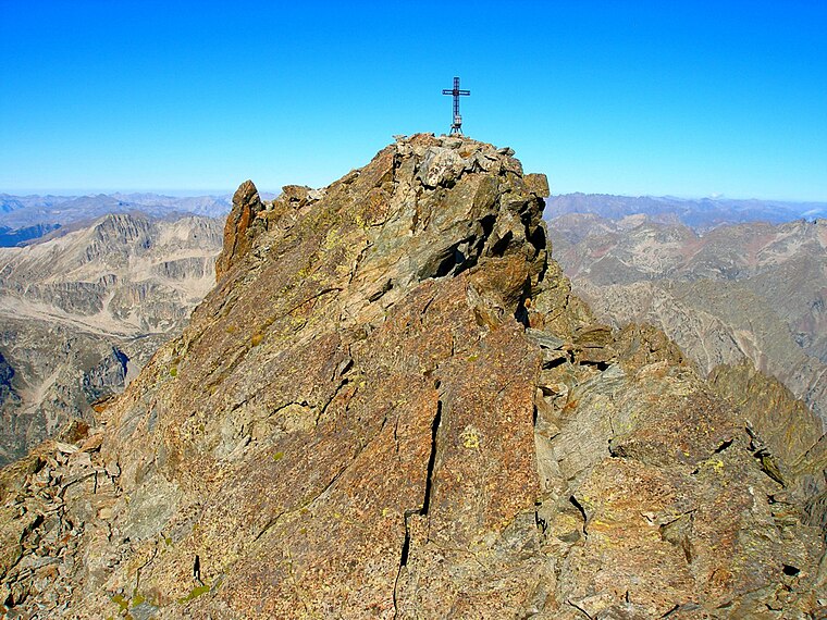
Photo: Francofranco56, Public domain.
Cima di Nasta is a mountain in the Maritime Alps. It is located in the upper Gesso valley, between the comunes of Valdieri and Entracque, and belongs to the Argentera massif.
Cime de l’Agnel
Peak

Photo: Wikimedia, CC BY-SA 3.0.
Cime de l'Agnel is a mountain in France. It is one of the main peaks of the Mercantour-Argentera, upstream of Upper Boréon in the Vésubie, at the border between the Alpes-Maritimes and Piedmont.
Cima del Baus
Peak
Cima del Baus is a mountain in the Maritime Alps. It is located in the upper Gesso Valley and is part of the Argentera massif. It lies entirely within Italian territory, on the border between the municipalities of Entracque and Valdieri.
Baisse du Clot Aut
- Type: Mountain saddle with an elevation of 2,926 metres
- Category: landform
- Location: Valdieri, Province of Cuneo, Piedmont, Northwest Italy, Italy, Europe
- View on OpenStreetMap
Latitude
44.1468° or 44° 8′ 49″ northLongitude
7.312° or 7° 18′ 43″ eastElevation
2,926 metres (9,600 feet)Open location code
8FP948W6+PROpenStreetMap ID
node 13342644983OpenStreetMap feature
natural=saddle
This page is based on OpenStreetMap, Wikidata, and Wikimedia Commons.
We’d love your help improving our open data sources. Thank you for contributing.
Satellite Map
Discover Baisse du Clot Aut from above in high-definition satellite imagery.
Localities in the Area
Explore places such as Valle di Nasta and Vallon de la Malariba.
Notable Places Nearby
Highlights include Cime Guilié and Col de Maute.
Piedmont: Must-Visit Destinations
Delve into Turin, Novara, Asti, and Alessandria.
Curious Mountain Saddles to Discover
Uncover intriguing mountain saddles from every corner of the globe.
About Mapcarta. Data © OpenStreetMap contributors and available under the Open Database License". Text is available under the CC BY-SA 4.0 license, except for photos, directions, and the map. Photo: Wikimedia, CC BY-SA 3.0.