Ballysillan Road
Ballysillan Road is a bus stop in Northern Ireland, United Kingdom. Ballysillan Road is situated nearby to Eglinton Presbyterian Church, as well as near Holy Trinity Church.| Tap on a place to explore it |
Places of Interest Nearby
Highlights include Belfast Boys’ Model School and Belfast Castle.
Belfast Boys’ Model School
School
Belfast Boys' Model School is a boys only secondary school in Belfast, Northern Ireland. Belfast Boys’ Model School is situated 1,000 feet northeast of Ballysillan Road.
Belfast Castle

Photo: Johnnykimble, CC BY-SA 3.0.
Belfast Castle is a mansion located in Cave Hill Country Park in Belfast, Northern Ireland, in a prominent position 400 feet above sea level. Its location provides unobstructed views over the City of Belfast and Belfast Lough. Belfast Castle is situated 1¼ miles northeast of Ballysillan Road.
Cliftonville Golf Club
Golf course
Cliftonville Golf Club is located on Westland Road in north Belfast. It consists of a 9-hole course with an eighteen-hole par of 70. The club was founded in 1911. Cliftonville Golf Club is situated 2,600 feet southeast of Ballysillan Road.
Places in the Area
Nearby places include New Lodge and Cathedral Quarter.
New Lodge
Suburb

Photo: Gerry Lynch, CC BY 2.5.
The New Lodge is an urban, working class Catholic community in Belfast, Northern Ireland, immediately to the north of the city centre. The landscape is dominated by several large tower blocks. New Lodge is situated 2 miles southeast of Ballysillan Road.
Cathedral Quarter
Quarter

Photo: Stuart, CC BY-SA 2.0.
The Cathedral Quarter in Belfast, Northern Ireland, is a developing area of the city, roughly situated between Royal Avenue near where the Belfast Central Library building is, and the Dunbar Link in the city centre. Cathedral Quarter is situated 2½ miles southeast of Ballysillan Road.
Belfast
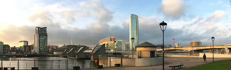
Photo: Davidwiltonone, CC BY-SA 4.0.
Belfast is the capital and largest city of Northern Ireland. Most of it historically lay in County Antrim west of the River Lagan, with about a third on the east bank in County Down, but it's always been governed as a separate metropolis, with a population in 2024 of about 671,000.
Ballysillan Road
- Type: Bus stop
- Category: transportation
- Location: Northern Ireland, United Kingdom, Britain and Ireland, Europe
- View on OpenStreetMap
Latitude
54.62981° or 54° 37′ 47″ northLongitude
-5.96311° or 5° 57′ 47″ westOperator
TranslinkNetwork
MetroOpen location code
9C6PJ2HP+WQOpenStreetMap ID
node 13391561034OpenStreetMap feature
highway=bus_stopOpenStreetMap feature
public_transport=platform
This page is based on OpenStreetMap, Wikidata, and Wikimedia Commons.
We’d love your help improving our open data sources. Thank you for contributing.
Satellite Map
Discover Ballysillan Road from above in high-definition satellite imagery.
Notable Places Nearby
Highlights include Eglinton Presbyterian Church and Holy Trinity Church.
Nearby Places
Explore places such as Winemark and Carr’s Glen.
Northern Ireland: Must-Visit Destinations
Delve into Belfast, Derry, Giant’s Causeway, and Armagh.
Curious Bus Stops to Discover
Uncover intriguing bus stops from every corner of the globe.
About Mapcarta. Data © OpenStreetMap contributors and available under the Open Database License". Text is available under the CC BY-SA 4.0 license, except for photos, directions, and the map. Photo: Chmee2, CC BY 3.0.