Bouts
Bouts is a locality in Muker, Richmondshire District, England. Bouts is situated nearby to the locality Sleddale Pasture, as well as near Blackburn Edge.| Tap on a place to explore it |
Places of Interest
Highlights include Great Shunner Fell and Buttertubs Pass.
Great Shunner Fell
Scenic viewpoint

Photo: Kreuzschnabel, CC BY-SA 3.0.
Great Shunner Fell is the third-highest mountain in the Yorkshire Dales, North Yorkshire, England, and the highest point in Wensleydale; at 716 metres above sea level.
Buttertubs Pass
Mountain saddle
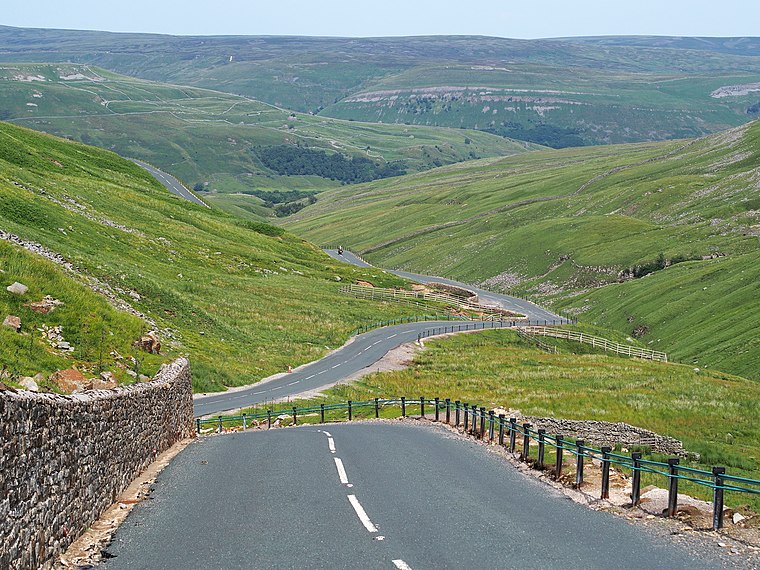
Photo: Kreuzschnabel, CC BY-SA 3.0.
The Buttertubs Pass is a high road in the Yorkshire Dales, England. The road winds its way north from Simonstone near Hawes towards Thwaite and Muker past 20-metre-deep limestone potholes called the Buttertubs. Buttertubs Pass is situated 2½ miles southeast of Bouts.
Hugh Seat
Peak
Hugh Seat is a mountain, or more accurately a fell, in Mallerstang on the eastern edge of Cumbria, England. It lies on the border between Cumbria and North Yorkshire. Hugh Seat is situated 2½ miles west of Bouts.
Places in the Area
Nearby places include Angram and Thwaite.
Angram
Hamlet

Photo: Mick Garratt, CC BY-SA 2.0.
Angram is a hamlet in the Yorkshire Dales in the county of North Yorkshire, England. It is near Keld to the north and Thwaite to the south. Angram forms part of the civil parish of Muker. Angram is situated 2½ miles east of Bouts.
Thwaite
Hamlet
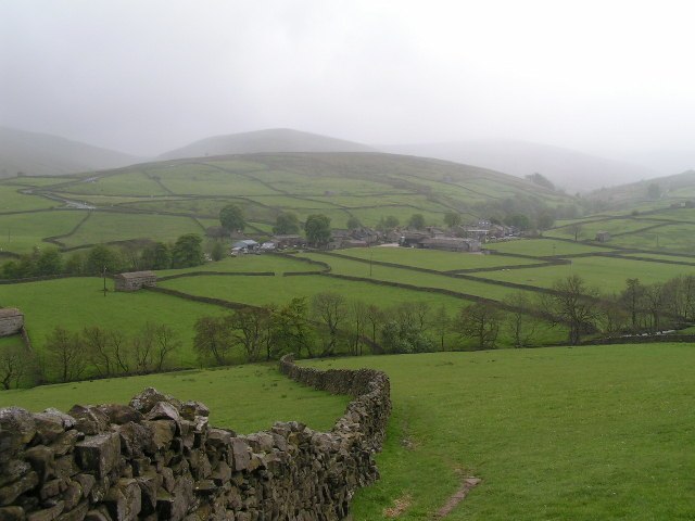
Photo: Dave Dunford, CC BY-SA 2.0.
Thwaite is a small village in the Yorkshire Dales, North Yorkshire, England. It is in Swaledale and is part of the civil parish of Muker. The village lies on the B6270 road that runs through Swaledale from east to west and is 9.3 miles west of Reeth. Thwaite is situated 2½ miles east of Bouts.
Cotterdale
Village

Photo: WALKER, CC BY-SA 2.0.
Cotterdale is a small side dale and hamlet on the north side of Wensleydale in North Yorkshire, England. The dale lies to the west of Great Shunner Fell. Cotterdale is situated 3 miles south of Bouts.
Bouts
- Type: Locality
- Location: Muker, Richmondshire District, North Yorkshire, Yorkshire, England, United Kingdom, Britain and Ireland, Europe
- View on OpenStreetMap
Latitude
54.38356° or 54° 23′ 1″ northLongitude
-2.23511° or 2° 14′ 6″ westOpen location code
9C6V9QM7+CXOpenStreetMap ID
node 13397676683OpenStreetMap feature
place=locality
This page is based on OpenStreetMap, Wikidata, and Wikimedia Commons.
We’d love your help improving our open data sources. Thank you for contributing.
Satellite Map
Discover Bouts from above in high-definition satellite imagery.
Places with the Same Name
Discover other places named “Bouts”.
Localities in the Area
Explore places such as Sleddale Pasture and Blackburn Edge.
Notable Places Nearby
Highlights include Shunner Fell Well and Dam Hill.
North Yorkshire: Must-Visit Destinations
Delve into York, Middlesbrough, Scarborough, and Ripon.
Curious Localities to Discover
Uncover intriguing localities from every corner of the globe.
About Mapcarta. Data © OpenStreetMap contributors and available under the Open Database License". Text is available under the CC BY-SA 4.0 license, except for photos, directions, and the map. Photo: Michael Bryan, CC BY 2.0.