Poggio della Cappella
Poggio della Cappella is a peak in Chiusdino, Siena, Tuscany and has an elevation of 344 metres. Poggio della Cappella is situated nearby to the hamlet San Galgano, as well as near the locality Le Gore.| Tap on a place to explore it |
Places of Interest
Highlights include Abbey of San Galgano and Eremo di Montesiepi.
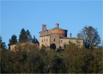
Abbey of San Galgano

Photo: PaestumPaestum, CC BY 4.0.
The Abbey of Saint Galgano was a Cistercian Monastery founded in the valley of the river Merse between the towns of Chiusdino and Monticiano, in the province of Siena, region of Tuscany, Italy.
Places in the Area
Nearby places include Monticiano and Chiusdino.
Monticiano
Village

Photo: LigaDue, CC BY-SA 4.0.
Monticiano is a town and comune on the right bank of the Val di Merse, Province of Siena, Tuscany, central Italy. The town is situated on the Colline Metallifere. One of its frazioni, Bagni di Petriolo, is popular for its thermal waters.
Chiusdino
Village

Photo: LigaDue, CC BY-SA 4.0.
Chiusdino is a comune in the Province of Siena in the Italian region Tuscany, located about 70 kilometres south of Florence and about 30 kilometres southwest of Siena.
Palazzetto
Village

Photo: Stef72, CC BY-SA 4.0.
Palazzetto is a village in Tuscany, central Italy, administratively a frazione of the comune of Chiusdino, province of Siena. At the time of the 2001 census its population was 100.
Poggio della Cappella
- Type: Peak with an elevation of 344 metres
- Category: landform
- Location: Chiusdino, Siena, Tuscany, Central Italy, Italy, Europe
- View on OpenStreetMap
Latitude
43.1545° or 43° 9′ 16″ northLongitude
11.1584° or 11° 9′ 30″ eastElevation
344 metres (1,129 feet)Open location code
8FMH5535+Q9OpenStreetMap ID
node 1384984200OpenStreetMap feature
natural=peak
This page is based on OpenStreetMap, Wikidata, and Wikimedia Commons.
We’d love your help improving our open data sources. Thank you for contributing.
Satellite Map
Discover Poggio della Cappella from above in high-definition satellite imagery.
Localities in the Area
Explore places such as San Galgano and Le Gore.
Notable Places Nearby
Highlights include Spada nella Roccia di San Galgano and Cimitero di San Galgano.
Siena: Must-Visit Destinations
Delve into Siena, San Gimignano, Pienza, and Montepulciano.
Curious Peaks to Discover
Uncover intriguing peaks from every corner of the globe.
About Mapcarta. Data © OpenStreetMap contributors and available under the Open Database License". Text is available under the CC BY-SA 4.0 license, except for photos, directions, and the map. Photo: Wikimedia, CC0.