Goudriaankade
Goudriaankade is a tram stop in The Hague, Rotterdam-The Hague Metropolitan Region, South Holland. Goudriaankade is situated nearby to the bridge Laakbrug, as well as near the health club De Haagse Hogeschool Sport & Fitness.| Tap on a place to explore it |
Places of Interest Nearby
Highlights include Den Haag Hollands Spoor Railway Station and Mauritshuis.
Den Haag Hollands Spoor Railway Station
Railway station

Photo: Sneeuwvlakte, CC BY-SA 4.0.
Den Haag HS, an abbreviation of the original name Den Haag Hollands Spoor, is the oldest train station in The Hague, South Holland, Netherlands, located on the Amsterdam–Haarlem–Rotterdam railway. Den Haag Hollands Spoor Railway Station is situated 430 metres northwest of Goudriaankade.
Mauritshuis
Castle

Photo: Roman Boed, CC BY 2.0.
The Mauritshuis is an art museum in The Hague, Netherlands. The museum houses the Royal Cabinet of Paintings which consists of 854 objects, mostly Dutch Golden Age paintings. Mauritshuis is situated 1½ km northwest of Goudriaankade.
Royal Library of the Netherlands
Library
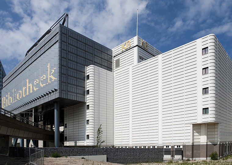
Photo: Koninklijke Bibliotheek, CC BY-SA 2.0.
The KB National Library of the Netherlands is the national library of the Netherlands, based in The Hague, founded in 1798. The KB collects everything that is published in and concerning the Netherlands, from medieval literature to today's publications. Royal Library of the Netherlands is situated 1½ km north of Goudriaankade.
Places in the Area
Nearby places include Laak and Stationsbuurt.
Laak
Suburb

Photo: Ymblanter, CC BY-SA 4.0.
Laak is district of The Hague, Netherlands. With a population of 48,255 and an area of 4.3 square kilometres, it is the smallest and least populous of the city's eight districts.

Rivierenbuurt, The Hague
Neighborhood

Photo: Wikimedia, CC BY-SA 4.0.
Rivierenbuurt, The Hague is a neighborhood.
Goudriaankade
- Type: Tram stop
- Categories: railway stop, transport stop, and transportation
- Location: The Hague, Rotterdam-The Hague Metropolitan Region, South Holland, Western Netherlands, Netherlands, Benelux, Europe
- View on OpenStreetMap
Latitude
52.06823° or 52° 4′ 6″ northLongitude
4.32771° or 4° 19′ 40″ eastOperator
HTM PersonenvervoerNetwork
Rail Haaglanden ConcessionOpen location code
9F46389H+73OpenStreetMap ID
node 1699278271OpenStreetMap feature
public_transport=stop_positionOpenStreetMap feature
railway=tram_stop
This page is based on OpenStreetMap, Wikidata, and Wikimedia Commons.
We’d love your help improving our open data sources. Thank you for contributing.
Satellite Map
Discover Goudriaankade from above in high-definition satellite imagery.
Notable Places Nearby
Highlights include Laakbrug and De Haagse Hogeschool Sport & Fitness.
Nearby Places
Explore places such as Goudriaankade and Den Haag, Goudriaankade.
Rotterdam-The Hague Metropolitan Region: Must-Visit Destinations
Delve into Rotterdam, Delft, Zoetermeer, and Centrum.
Curious Tram Stops to Discover
Uncover intriguing tram stops from every corner of the globe.
About Mapcarta. Data © OpenStreetMap contributors and available under the Open Database License". Text is available under the CC BY-SA 4.0 license, except for photos, directions, and the map. Photo: 1Veertje, CC BY-SA 3.0.