Vindplaats Romeins schip ‘De Meern 1’
Vindplaats Romeins schip ‘De Meern 1’ is an archaeological site in Utrecht, Utrecht. Vindplaats Romeins schip ‘De Meern 1’ is situated nearby to Balijepark, as well as near the pitch B Plein.| Tap on a place to explore it |
Places of Interest Nearby
Highlights include Nijeveld and Marekerk (De Meern).
Nijeveld
Archaeological site

Photo: Wikimedia, Public domain.
Nijeveld is an archaeological site, which is situated 320 metres west of Vindplaats Romeins schip ‘De Meern 1’.
Marekerk (De Meern)
Church
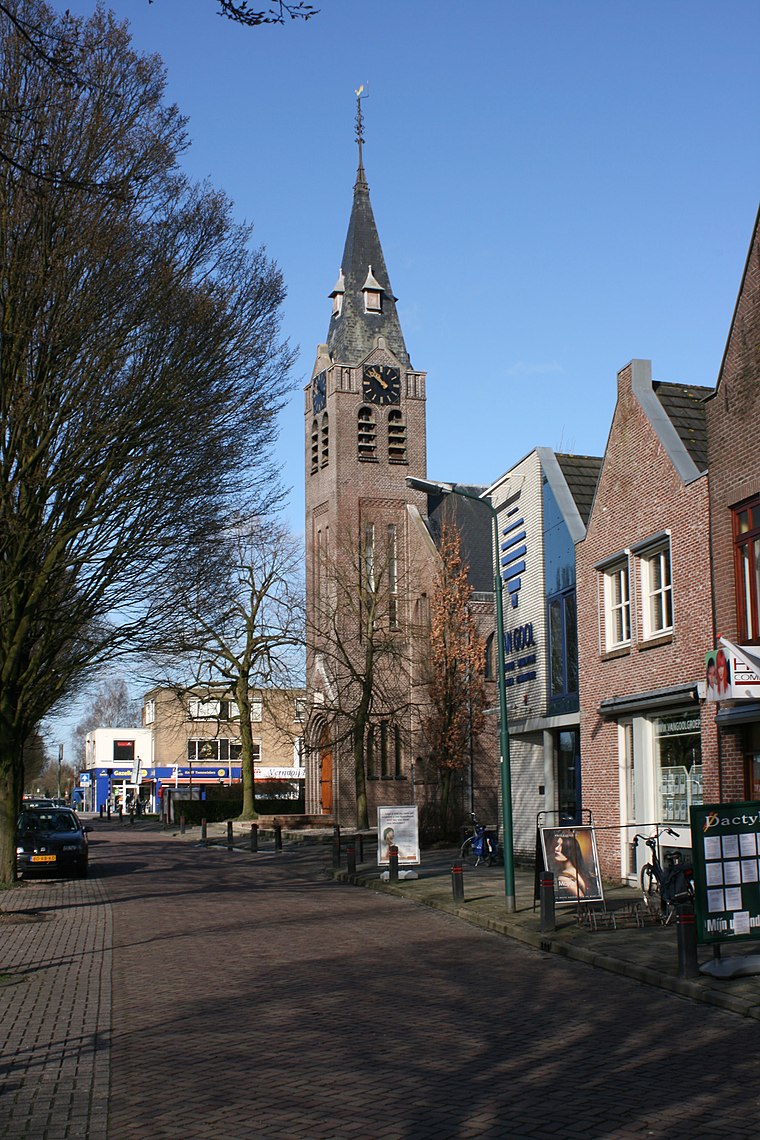
Photo: Wikimedia, CC BY-SA 2.5.
Marekerk (De Meern) is a church, which is situated 1¼ km east of Vindplaats Romeins schip ‘De Meern 1’.
Vleuterweide public library and drop point
Library

Photo: Petraotten, CC BY-SA 3.0.
Vleuterweide public library and drop point is situated 1½ km north of Vindplaats Romeins schip ‘De Meern 1’.
Places in the Area
Nearby places include Veldhuizen and De Meern.
Veldhuizen
Quarter

Photo: Jan dijkstra, CC BY-SA 3.0.
Veldhuizen is a hamlet in the Dutch province of Utrecht. It is located in the municipality of Utrecht, south of De Meern. It is also the name of a new neighbourhood of Utrecht, built close to the hamlet.
De Meern
Town
Photo: Wikimedia, CC BY-SA 2.5.
De Meern is an urbanized village in the Dutch province of Utrecht. It is a part of the municipality of Utrecht, and is located at 6 km west of the inner city of this town.

Vindplaats Romeins schip ‘De Meern 1’
- Type: Archaeological site
- Inscription: “Vindplaats Romeins schip ‘De Meern 1’”
- Categories: historic site, tourist attraction, and tourism
- Location: Utrecht, Utrecht, Western Netherlands, Netherlands, Benelux, Europe
- View on OpenStreetMap
Latitude
52.08094° or 52° 4′ 51″ northLongitude
5.02023° or 5° 1′ 13″ eastOpen location code
9F4732JC+93OpenStreetMap ID
node 1726114220OpenStreetMap feature
historic=archaeological_site
This page is based on OpenStreetMap, Wikidata, and Wikimedia Commons.
We’d love your help improving our open data sources. Thank you for contributing.
Satellite Map
Discover Vindplaats Romeins schip ‘De Meern 1’ from above in high-definition satellite imagery.
Notable Places Nearby
Highlights include Balijepark and B Plein.
Nearby Places
Explore places such as Swami Vivekananda and De liemes.
Utrecht: Must-Visit Destinations
Delve into Amersfoort, Zeist, Veenendaal, and Soest.
Curious Archaeological Sites to Discover
Uncover intriguing archaeological sites from every corner of the globe.
About Mapcarta. Data © OpenStreetMap contributors and available under the Open Database License". Text is available under the CC BY-SA 4.0 license, except for photos, directions, and the map. Photo: Al1 73, CC BY-SA 3.0.