HaHaluts/HaMeyasdim
HaHaluts/HaMeyasdim is a bus stop in Jerusalem District, Israel. HaHaluts/HaMeyasdim is situated nearby to the playground גינת ביאליק, as well as near the park bialik.| Tap on a place to explore it |
Places of Interest Nearby
Highlights include National Library of Israel and Israel Museum.
National Library of Israel
Library

Photo: Wikimedia, CC BY-SA 4.0.
The National Library of Israel, formerly Jewish National and University Library, is the library dedicated to collecting the cultural treasures of Israel and of Jewish heritage. National Library of Israel is situated 580 metres east of HaHaluts/HaMeyasdim.
Israel Museum
Museum

Photo: אסף.צ, CC BY-SA 3.0.
The Israel Museum is an art and archaeology museum in Jerusalem. It was established in 1965 as Israel's largest and foremost cultural institution, and an encyclopedic museum. Israel Museum is situated 1¼ km southeast of HaHaluts/HaMeyasdim.
Hebrew language academy
College

Photo: דניאל צבי, Public domain.
The Academy of the Hebrew Language was established by the Israeli government in 1953 as the "supreme institution for scholarship on the Hebrew language in the Hebrew University of Jerusalem of Givat Ram campus." Its stated aims are to assemble and research… Hebrew language academy is situated 1 km southeast of HaHaluts/HaMeyasdim.
Places in the Area
Nearby places include Beit HaKerem and Yefe Nof.
Beit HaKerem
Suburb
Beit HaKerem is a largely secular upscale neighborhood in southwest Jerusalem. It is located between Kiryat Moshe to the northwest and Bayit VeGan to the south. Beit HaKerem has a population of 15,000.
Yefe Nof
Suburb
Yefeh Nof is a neighborhood in west Jerusalem, founded in 1929. Together with Ramat Beit HaKerem and Givat Beit HaKerem, it is part of the larger Beit HaKerem neighborhood.
Givat Ram
Suburb
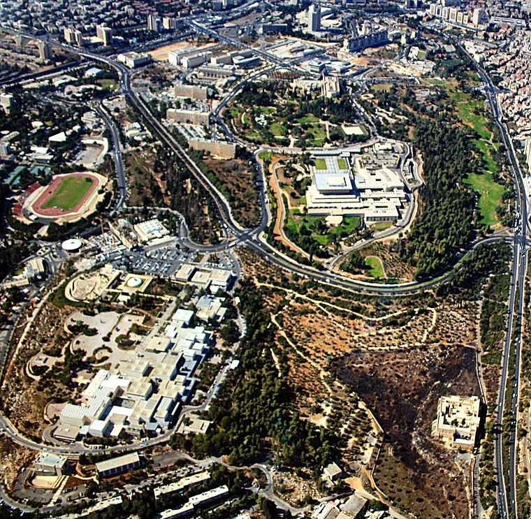
Photo: Neukoln, CC BY-SA 3.0.
Givat Ram is a neighborhood in central Jerusalem. It is the site of Kiryat HaMemshala, which includes many of Israel's most important national institutions, among them the Knesset, the Israel Museum, the Supreme Court, Bank of Israel, Academy of the Hebrew Language, National Library, one of the campuses of the Hebrew University of Jerusalem, and many government ministries' offices.
HaHaluts/HaMeyasdim
- Type: Bus stop
- Category: transportation
- Location: Jerusalem District, Israel, Middle East, Asia
- View on OpenStreetMap
Latitude
31.77745° or 31° 46′ 39″ northLongitude
35.19082° or 35° 11′ 27″ eastOpen location code
8G3QQ5GR+X8OpenStreetMap ID
node 1803021511OpenStreetMap feature
highway=bus_stopOpenStreetMap feature
public_transport=platform
This page is based on OpenStreetMap, Wikidata, and Wikimedia Commons.
We’d love your help improving our open data sources. Thank you for contributing.
Satellite Map
Discover HaHaluts/HaMeyasdim from above in high-definition satellite imagery.
In Other Languages
From Arabic to Hebrew—“HaHaluts/HaMeyasdim” goes by many names.
- Arabic: “هحلوتس/همِيَسديم”
- Hebrew: “החלוץ/המייסדים”
Notable Places Nearby
Highlights include bialik and גינת ביאליק.
Nearby Places
Explore places such as HaHaluts/HaMeyasdim and WIZO Family Center.
Israel: Must-Visit Destinations
Delve into Tel Aviv, Haifa, Nazareth, and Carmel Range.
Curious Bus Stops to Discover
Uncover intriguing bus stops from every corner of the globe.
About Mapcarta. Data © OpenStreetMap contributors and available under the Open Database License". Text is available under the CC BY-SA 4.0 license, except for photos, directions, and the map. Photo: Bienchido, CC BY-SA 3.0.