Taxi Stand Charles Street
Taxi Stand Charles Street is a taxicab stand in Launceston, Eastern Tasmania, Tasmania. Taxi Stand Charles Street is situated nearby to the place of worship Synagogue, as well as near the health club Zap fitness.| Tap on a place to explore it |
Places of Interest Nearby
Highlights include Prince’s Square and St John’s Church, Launceston.
Prince’s Square
Park

Photo: Wriekhathaar, CC BY-SA 4.0.
Prince's Square is a park in Launceston, Tasmania, Australia. Established in 1858 from a disused brickfield it is now an important part of cultural life in Launceston and also a heritage park. Prince’s Square is situated 170 metres southeast of Taxi Stand Charles Street.
St John’s Church, Launceston
Church

Photo: Wriekhathaar, CC BY-SA 4.0.
St Johns Church, is an Anglican church in Launceston, Tasmania and the oldest church in the city, construction having started in 1824. Though the church is one of the oldest surviving churches in Australia, it has received numerous extensions and modifications with only the tower and first window pair of the nave being original. St John’s Church, Launceston is situated 220 metres east of Taxi Stand Charles Street.
Princess Theatre
Theater building
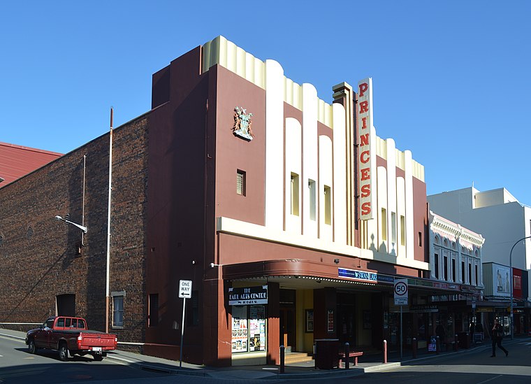 The Princess Theatre is a historic theatre in Launceston, Tasmania, Australia. Princess Theatre is situated 420 metres northeast of Taxi Stand Charles Street.
Places in the Area
Nearby places include East Launceston and West Launceston.
East Launceston
Suburb
East Launceston is a residential locality in the local government area of Launceston in the Launceston LGA region of Tasmania. The locality is about 1 kilometre east of the town of Launceston.
West Launceston
Suburb
West Launceston is a residential locality in the local government area of Launceston in the Launceston LGA region of Tasmania. The locality is about 3 kilometres south-west of the town of Launceston.
South Launceston
Suburb
South Launceston is a residential locality in the local government area of Launceston in the Launceston LGA region of Tasmania. The locality is about 3 kilometres south of the town of Launceston.
Taxi Stand Charles Street
- Type: Taxicab stand
- Category: transportation
- Location: Launceston, Eastern Tasmania, Tasmania, Australia, Oceania
- View on OpenStreetMap
Latitude
-41.43949° or 41° 26′ 22″ southLongitude
147.13882° or 147° 8′ 20″ eastOpen location code
4RC9H46Q+6GOpenStreetMap ID
node 1999456048OpenStreetMap feature
amenity=taxi
This page is based on OpenStreetMap, Wikidata, and Wikimedia Commons.
We’d love your help improving our open data sources. Thank you for contributing.
Satellite Map
Discover Taxi Stand Charles Street from above in high-definition satellite imagery.
Places with the Same Name
Discover other places named “Taxi Stand Charles Street”.
Notable Places Nearby
Highlights include Synagogue and Zap fitness.
Nearby Places
Explore places such as King of Kebabs and Bengal Tiger.
Eastern Tasmania: Must-Visit Destinations
Delve into Maria Island National Park, St Helens, Scottsdale, and Longford.
Curious Taxicab Stands to Discover
Uncover intriguing taxicab stands from every corner of the globe.
About Mapcarta. Data © OpenStreetMap contributors and available under the Open Database License". Text is available under the CC BY-SA 4.0 license, except for photos, directions, and the map. Photo: Wikimedia, Public domain.