Pointhouse Road / SECC
Pointhouse Road / SECC is a bus stop in Glasgow City, Scotland. Pointhouse Road / SECC is situated nearby to Yorkhill Fire Station, as well as near Clydeside Distillery.| Tap on a place to explore it |
Places of Interest Nearby
Highlights include Kelvingrove Art Gallery and Museum and Glasgow Science Centre.
Kelvingrove Art Gallery and Museum
Museum

Photo: 瑞丽江的河水, CC BY-SA 4.0.
Kelvingrove Art Gallery and Museum is a museum and art gallery in the Yorkhill area of Glasgow, Scotland, managed by Glasgow Museums. The building is located in Kelvingrove Park in the West End of the city, adjacent to Argyle Street. Kelvingrove Art Gallery and Museum is situated 2,200 feet north of Pointhouse Road / SECC.
Glasgow Science Centre
Museum
 Glasgow Science Centre is a visitor attraction located in the Clyde Waterfront Regeneration area on the south bank of the River Clyde in Glasgow, Scotland. Glasgow Science Centre is situated 1,600 feet south of Pointhouse Road / SECC.
Glasgow Rangers
Stadium
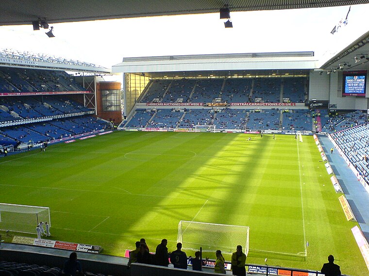
Photo: Archibald99, Public domain.
Ibrox Stadium is a football stadium on the south side of the River Clyde in the Ibrox area of Glasgow, Scotland. The home of Scottish Premiership team Rangers, Ibrox is the third-largest football stadium in Scotland, with an all-seated capacity of 51,700. Glasgow Rangers is situated 1 mile southwest of Pointhouse Road / SECC.
Places in the Area
Nearby places include Kelvinhaugh and Finnieston.
Kelvinhaugh
Suburb

Photo: JamesGangel, CC BY-SA 4.0.
Kelvinhaugh is a neighbourhood in the city of Glasgow, Scotland. It is situated directly north of the River Clyde in the West End of the city. Its boundaries are not precisely defined, but roughly correspond to the River Clyde to the south, Yorkhill to the west, Finnieston to the east and Kelvingrove to the north, the division being Argyle Street.
Finnieston
Suburb

Photo: Finlay McWalter, CC BY-SA 3.0.
Finnieston is an area within the city of Glasgow, located in the central belt of Scotland, situated on the north bank of the River Clyde roughly between the city's West End and the city centre.
Pointhouse Road / SECC
- Type: Bus stop
- Category: transportation
- Location: Glasgow City, Scotland, United Kingdom, Britain and Ireland, Europe
- View on OpenStreetMap
Latitude
55.86291° or 55° 51′ 47″ northLongitude
-4.29383° or 4° 17′ 38″ westOpen location code
9C7QVP74+5FOpenStreetMap ID
node 2006630605OpenStreetMap feature
highway=bus_stopOpenStreetMap feature
public_transport=platform
This page is based on OpenStreetMap, Wikidata, and Wikimedia Commons.
We’d love your help improving our open data sources. Thank you for contributing.
Satellite Map
Discover Pointhouse Road / SECC from above in high-definition satellite imagery.
Notable Places Nearby
Highlights include Yorkhill Fire Station and Clydeside Distillery.
Nearby Places
Explore places such as Finnieston, Pointhouse Road/ SECC and SEC Car Park 6.
Scotland: Must-Visit Destinations
Delve into Edinburgh, Glasgow, Aberdeen, and Dundee.
Curious Bus Stops to Discover
Uncover intriguing bus stops from every corner of the globe.
About Mapcarta. Data © OpenStreetMap contributors and available under the Open Database License". Text is available under the CC BY-SA 4.0 license, except for photos, directions, and the map. Photo: Ritchyblack, FAL.