Cellier des Vignerons
Cellier des Vignerons is a convenience store in Vitry-sur-Seine, Arrondissement of L’Haÿ-les-Roses, Île-de-France. Cellier des Vignerons is situated nearby to the bike rental Gabriel Péri - Danielle Casanova, as well as near War memorial of Vitry-sur-Seine.| Tap on a place to explore it |
Places of Interest Nearby
Highlights include Gabriel Péri - Danielle Casanova and Exploradôme.
Gabriel Péri - Danielle Casanova
Bike rental

Photo: Chabe01, CC BY-SA 4.0.
Gabriel Péri - Danielle Casanova is a bike rental.
Exploradôme
Museum
Photo: Wikimedia, CC BY-SA 4.0.
The Exploradôme is a science museum located in Vitry-sur-Seine in the Val-de-Marne, France. It was founded by Goéry Delacôte. It is open daily; an admission fee is charged. Exploradôme is situated 680 metres northwest of Cellier des Vignerons.
War memorial of Vitry-sur-Seine
Memorial

Photo: Chabe01, CC BY-SA 4.0.
War memorial of Vitry-sur-Seine is situated 210 metres west of Cellier des Vignerons.
Places in the Area
Nearby places include Alfortville and Maisons-Alfort.
Alfortville
Town
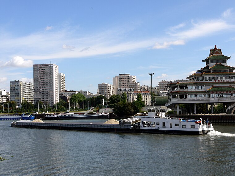
Photo: Pline, CC BY-SA 3.0.
Alfortville is a commune in the Val-de-Marne department in the southeastern suburbs of Paris, France. It is located 7.6 km from the center of Paris. It is one of the 13 communes in the intercommunality of Métropole du Grand Paris.
Maisons-Alfort
Town
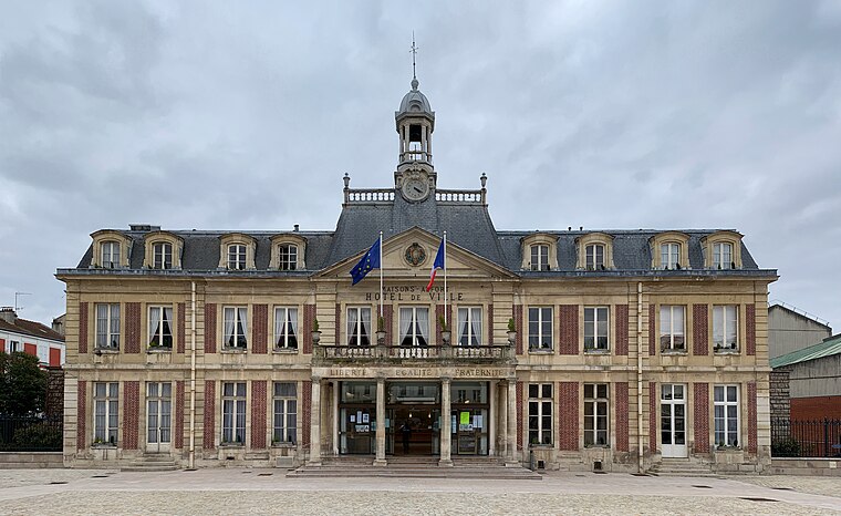
Photo: Chabe01, CC BY-SA 4.0.
Maisons-Alfort is a commune in the southeastern suburbs of Paris, France. It is located 8.4 km from the centre of Paris. Maisons-Alfort is famous as the location of the National Veterinary School of Alfort. Maisons-Alfort is situated 2½ km northeast of Cellier des Vignerons.
Ivry-sur-Seine
Town
 Ivry-sur-Seine is a commune in the Val-de-Marne department in the southeastern suburbs of Paris, France. It is located 5.3 km from the centre of Paris. Ivry-sur-Seine is situated 2½ km northwest of Cellier des Vignerons.
Cellier des Vignerons
- Type: Convenience store
- Categories: shop and food
- Location: Vitry-sur-Seine, Arrondissement of L’Haÿ-les-Roses, Val-de-Marne, Île-de-France, France, Europe
- View on OpenStreetMap
Latitude
48.79044° or 48° 47′ 26″ northLongitude
2.40143° or 2° 24′ 5″ eastOpen location code
8FW4QCR2+5HOpenStreetMap ID
node 2142861091OpenStreetMap feature
shop=convenience
This page is based on OpenStreetMap, Wikidata, and Wikimedia Commons.
We’d love your help improving our open data sources. Thank you for contributing.
Satellite Map
Discover Cellier des Vignerons from above in high-definition satellite imagery.
Notable Places Nearby
Highlights include Stade Gabriel Péri and Place des Martyrs de la Déportation.
Nearby Places
Explore places such as Pharmacie Nguyen and Carrosserie rue Gabriel Péri.
Île-de-France: Must-Visit Destinations
Delve into Paris, Versailles, Boulogne-Billancourt, and Paris Charles de Gaulle Airport.
Curious Convenience Stores to Discover
Uncover intriguing convenience stores from every corner of the globe.
About Mapcarta. Data © OpenStreetMap contributors and available under the Open Database License". Text is available under the CC BY-SA 4.0 license, except for photos, directions, and the map. Photo: Guillaume Baviere, CC BY 2.0.