Schoolke Rugge
Schoolke Rugge is a school in Avelgem, Arrondissement of Kortrijk, Flanders which is located on Ruggestraat. Schoolke Rugge is situated nearby to the health club Basic-Fit, as well as near the electrical substation Avelgem substation.| Tap on a place to explore it |
Places of Interest Nearby
Highlights include Avelgem substation and Brug van de Waterhoek.
Avelgem substation
Electrical substation

Photo: Fluppe37, CC BY-SA 3.0.
Avelgem substation is an electrical substation, which is situated 380 metres northeast of Schoolke Rugge.
Brug van de Waterhoek
Bridge

Photo: Wikimedia, Public domain.
Brug van de Waterhoek is a bridge, which is situated 1 km southeast of Schoolke Rugge.
Saint Martin’s Church (Avelgem)
Church
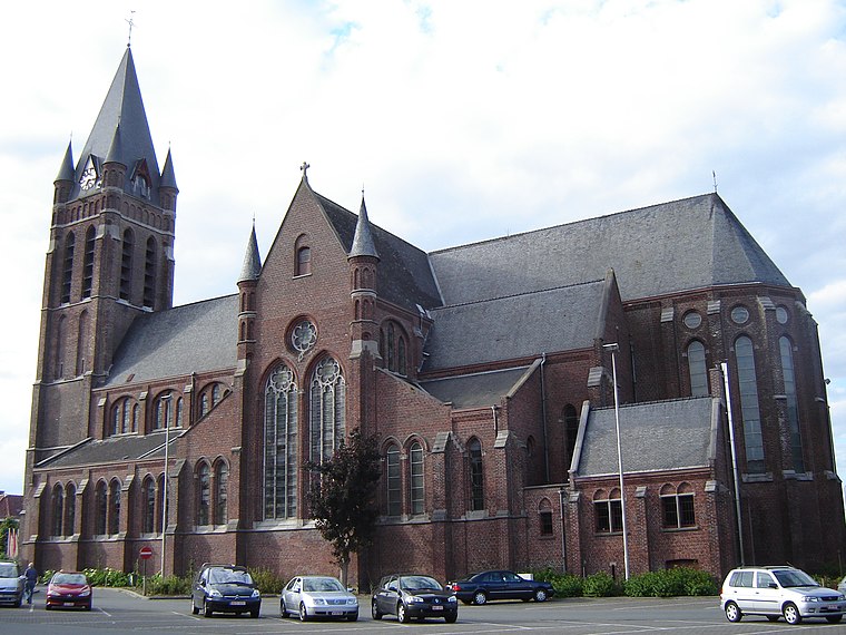 Saint Martin’s Church (Avelgem) is situated 1¼ km southwest of Schoolke Rugge.
Places in the Area
Nearby places include Escanaffles and Tiegem.
Escanaffles
Village

Photo: Jean-Pol GRANDMONT, CC BY 3.0.
Escanaffles is a village of Wallonia in the Belgian municipality of Celles, Hainaut Province. Escanaffles is situated 3 km south of Schoolke Rugge.
Tiegem
Village
 Tiegem is a village in the municipality of Anzegem, near Oudenaarde, West Flanders, Belgium. Tiegem was the birthplace of St. Arnold of Soissons. Tiegem is situated 3 km north of Schoolke Rugge.

Schoolke Rugge
- Type: School
- Address: Ruggestraat 39
- Category: education
- Location: Avelgem, Arrondissement of Kortrijk, West Flanders, Flanders, Belgium, Benelux, Europe
- View on OpenStreetMap
Latitude
50.7803° or 50° 46′ 49″ northLongitude
3.46517° or 3° 27′ 55″ eastOperator
vzw Katholiek BasisonderwijsOpen location code
9F25QFJ8+43OpenStreetMap ID
node 2152485228OpenStreetMap feature
amenity=school
This page is based on OpenStreetMap, Wikidata, and Wikimedia Commons.
We’d love your help improving our open data sources. Thank you for contributing.
Satellite Map
Discover Schoolke Rugge from above in high-definition satellite imagery.
Notable Places Nearby
Highlights include Basic-Fit and Geboortebos.
Nearby Places
Explore places such as Avelgem Rugge Dorp and Café Waterhoek.
West Flanders: Must-Visit Destinations
Delve into Bruges, Kortrijk, Ypres, and Ostend.
Curious Places to Discover
Uncover intriguing places from every corner of the globe.
About Mapcarta. Data © OpenStreetMap contributors and available under the Open Database License". Text is available under the CC BY-SA 4.0 license, except for photos, directions, and the map. Photo: MJJR, CC BY 3.0.