Sgiath Chrom
Sgiath Chrom is a locality in Stirling, Scotland. Sgiath Chrom is situated nearby to the locality Creag nan Uan, as well as near the hamlet Auchessan.| Tap on a place to explore it |
Places of Interest
Highlights include Sgiath Chùil and Beinn Cheathaich.
Sgiath Chùil
Peak

Photo: Richard Webb, CC BY-SA 2.0.
Sgiath Chùil is a mountain in the southern highlands of Scotland. It stands within Loch Lomond and the Trossachs National Park, on its northern border. It is about 11 kilometres west of Killin.
Beinn Cheathaich
Peak

Photo: Thomas Dick, CC BY-SA 2.0.
Beinn Cheathaich is a peak, which is situated 2 miles northwest of Sgiath Chrom.
Meall Glas
Peak

Photo: Mick Knapton, CC BY-SA 3.0.
Meall Glas is a mountain situated in the southern highlands of Scotland. It stands on the northern border of the Loch Lomond and the Trossachs National Park, 8.5 kilometres north east of Crianlarich. Meall Glas is situated 2½ miles west of Sgiath Chrom.
Places in the Area
Nearby places include Auchlyne and Ardchyle.
Auchlyne
Hamlet

Photo: Dave Fergusson, CC BY-SA 2.0.
Auchlyne is a small hamlet in Stirling, Scotland. It is located approximately five miles west of Killin on Loch Tay, off the main A85 road that runs from Perth to Oban. Auchlyne is situated 3 miles east of Sgiath Chrom.
Ardchyle
Hamlet
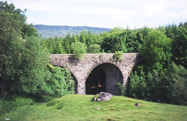
Photo: Wikimedia, CC BY-SA 2.0.
Ardchyle is a small hamlet in Stirling, Scotland. The Glendhu viaduct, just south of Ardchyle, was built for the now disused section of the Callander and Oban Railway which closed in 1965 after a landslide. Ardchyle is situated 4 miles east of Sgiath Chrom.
Sgiath Chrom
- Type: Locality
- Location: Stirling, Scotland, United Kingdom, Britain and Ireland, Europe
- View on OpenStreetMap
Latitude
56.44684° or 56° 26′ 49″ northLongitude
-4.48612° or 4° 29′ 10″ westOpen location code
9C8QCGW7+PHOpenStreetMap ID
node 2415227505OpenStreetMap feature
place=locality
This page is based on OpenStreetMap, Wikidata, and Wikimedia Commons.
We’d love your help improving our open data sources. Thank you for contributing.
Satellite Map
Discover Sgiath Chrom from above in high-definition satellite imagery.
Localities in the Area
Explore places such as Creag nan Uan and Auchessan.
Notable Places Nearby
Highlights include Meall a‘ Churain and Glen Dochart Caravan Park.
Scotland: Must-Visit Destinations
Delve into Edinburgh, Glasgow, Aberdeen, and Dundee.
Curious Localities to Discover
Uncover intriguing localities from every corner of the globe.
About Mapcarta. Data © OpenStreetMap contributors and available under the Open Database License". Text is available under the CC BY-SA 4.0 license, except for photos, directions, and the map. Photo: Ritchyblack, FAL.