Cahaya Baru
Cahaya Baru is a supermarket in Baarn Municipality, Utrecht which is located on Laanstraat. Cahaya Baru is situated nearby to the bookstore Boekhandel Den Boer, as well as near the church Paaskerk.| Tap on a place to explore it |
- Type: Supermarket
- Cuisine: Asian
- Address: Laanstraat 101, Baarn, 3743BD
Places of Interest Nearby
Highlights include Paaskerk and Baarn railway station.
Paaskerk
Church

Photo: Atsje, CC BY-SA 3.0.
Paaskerk is a church, which is situated 180 metres southwest of Cahaya Baru.
Baarn railway station
Railway station
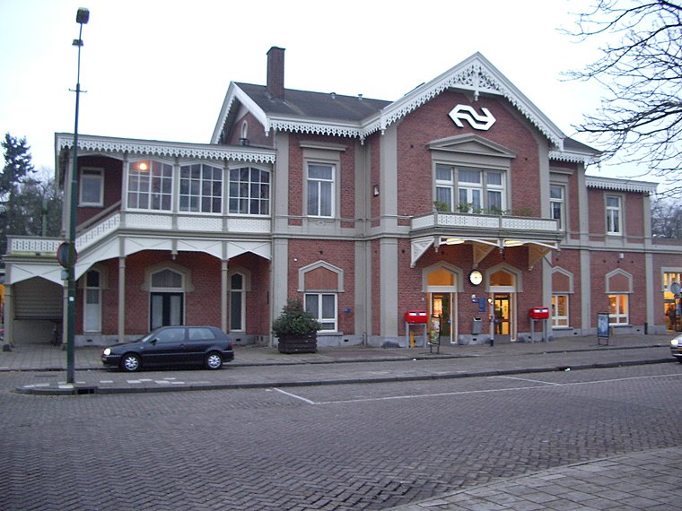
Photo: T Houdijk, CC BY-SA 3.0.
Baarn is a railway station on the Amsterdam–Zutphen railway and the Den Dolder–Baarn railway located in Baarn, Netherlands. The station is operated by the Nederlandse Spoorwegen. Baarn railway station is situated 500 metres south of Cahaya Baru.
Baarn Old Cemetery
Cemetery

Photo: Atsje, CC BY-SA 3.0.
Baarn Old Cemetery is situated 310 metres north of Cahaya Baru.
Places in the Area
Nearby places include Eembrugge and Soestdijk.
Eembrugge
Hamlet

Photo: Milliped, CC BY-SA 4.0.
Eembrugge is a hamlet and former city on the river Eem, east of Baarn, in the Netherlands. It received city rights between 1336 en 1340, but was destroyed in 1527. Eembrugge is partially in the municipality of Eemnes, partially in Baarn.
Soestdijk
Neighborhood

Photo: Wikimedia, CC BY-SA 4.0.
Soestdijk is a neighbourhood of Soest and a hamlet in the municipality of Baarn. Both are part of the province of Utrecht, Netherlands. The village gives its name to Paleis Soestdijk, which from 1937 to 2004 was the residence of Princess and later Queen Juliana and Prince Bernhard. Soestdijk is situated 3 km south of Cahaya Baru.
Soest

Photo: WeeJeeVee, CC BY-SA 3.0 nl.
Soest is a medium sized city in the Dutch province of Utrecht. It's known as a major base for the Dutch army, which uses large parts of forests and heathlands of the surrounding Soesterduinen and Soesterberg as training grounds.
Cahaya Baru
- Categories: shop and food
- Location: Baarn Municipality, Utrecht, Western Netherlands, Netherlands, Benelux, Europe
- View on OpenStreetMap
Latitude
52.21222° or 52° 12′ 44″ northLongitude
5.28445° or 5° 17′ 4″ eastOpen location code
9F47676M+VQOpenStreetMap ID
node 2740240424OpenStreetMap feature
shop=supermarketOpenStreetMap attribute
cuisine=asian
This page is based on OpenStreetMap, Wikidata, and Wikimedia Commons.
We’d love your help improving our open data sources. Thank you for contributing.
Satellite Map
Discover Cahaya Baru from above in high-definition satellite imagery.
Notable Places Nearby
Highlights include Boekhandel Den Boer and Adventkerk (CGK).
Nearby Places
Explore places such as Homy’s Hair & Beauty and Paul! Mediterrane Smaken.
Utrecht: Must-Visit Destinations
Delve into Utrecht, Amersfoort, Zeist, and Veenendaal.
Curious Supermarkets to Discover
Uncover intriguing supermarkets from every corner of the globe.
About Mapcarta. Data © OpenStreetMap contributors and available under the Open Database License". Text is available under the CC BY-SA 4.0 license, except for photos, directions, and the map. Photo: Atsje, CC0.