Op ‘t Landtweg 16
Op ‘t Landtweg 16 is a chalet in Schagen, North Holland Peninsula, North Holland which is located on Op ‘t Landtweg. Op ‘t Landtweg 16 is situated nearby to Museumboerderij Tante Jaantje, as well as near the public building KNRM station Callantsoog.| Tap on a place to explore it |
Places of Interest Nearby
Highlights include De Zwaan.
De Zwaan
Windmill

Photo: Quistnix, CC BY-SA 2.5.
De Zwaan is a windmill, which is situated 570 metres south of Op ‘t Landtweg 16.
Places in the Area
Nearby places include Callantsoog and De Stolpen.
Callantsoog
Village
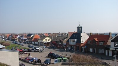
Photo: Arch, Public domain.
Callantsoog is a village in the Dutch province of North Holland. It is a part of the municipality of Schagen, and lies about 18 km south of Den Helder. Callantsoog was a separate municipality until 1990, when it was merged with Zijpe.
De Stolpen
Hamlet
De Stolpen is a hamlet in the Dutch province of North Holland. It is part of the municipality of Schagen, and is located about 3 km northwest of the village of Schagerbrug. De Stolpen is situated 3½ km southeast of Op ‘t Landtweg 16.
’t Zand, Schagen
Village

Photo: Wikimedia, CC BY-SA 4.0.
't Zand is a village in the Dutch province of North Holland. It is a part of the municipality of Schagen and lies about 12 kilometres south of Den Helder. ’t Zand, Schagen is situated 4 km east of Op ‘t Landtweg 16.
Op ‘t Landtweg 16
- Type: Chalet
- Address: Op ‘t Landtweg 16, Callantsoog, 1759GK
- Categories: tourism, accommodation, and building
- Location: Schagen, North Holland Peninsula, North Holland, Western Netherlands, Netherlands, Benelux, Europe
- View on OpenStreetMap
Latitude
52.83653° or 52° 50′ 12″ northLongitude
4.69424° or 4° 41′ 39″ eastOpen location code
9F46RMPV+JMOpenStreetMap ID
node 2786144859OpenStreetMap feature
tourism=chalet
This page is based on OpenStreetMap, Wikidata, and Wikimedia Commons.
We’d love your help improving our open data sources. Thank you for contributing.
Satellite Map
Discover Op ‘t Landtweg 16 from above in high-definition satellite imagery.
Notable Places Nearby
Highlights include Museumboerderij Tante Jaantje and KNRM station Callantsoog.
Nearby Places
Explore places such as Op ‘t Landweg 25 and Callantsoog vakantiehuisjes.
North Holland Peninsula: Must-Visit Destinations
Delve into Alkmaar, Hoorn, Den Helder, and Enkhuizen.
Curious Chalets to Discover
Uncover intriguing chalets from every corner of the globe.
About Mapcarta. Data © OpenStreetMap contributors and available under the Open Database License". Text is available under the CC BY-SA 4.0 license, except for photos, directions, and the map. Photo: Wikimedia, CC BY-SA 3.0.