Bubble Snap
Bubble Snap is a café in Edinburgh, Scotland which is located on St Leonard’s Street. Bubble Snap is situated nearby to the community center Nelson Hall Community Centre, as well as near the public building Historic Environment Scotland.| Tap on a place to explore it |
- Type: Café
- Cuisine: bubble tea
- Also known as: “Sterling Wigmaker”
- Address: 91 St Leonard’s Street, Edinburgh, EH8 9QY
Places of Interest Nearby
Highlights include Queen’s Hall and Edinburgh Castle.
Queen’s Hall
Theater building

Photo: Wikimedia, Copyrighted free use.
The Queen's Hall is a performance venue in the Southside, Edinburgh, Scotland. The building opened in 1824 as Hope Park Chapel and reopened as the Queen's Hall in 1979. Queen’s Hall is situated 640 feet southwest of Bubble Snap.
Edinburgh Castle
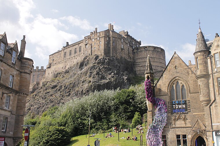
Photo: Stephencdickson, CC BY-SA 4.0.
Edinburgh Castle is a historic castle in Edinburgh, Scotland. It stands on Castle Rock, which has been occupied by humans since at least the Iron Age. There has been a royal castle on the rock since the reign of Malcolm III in the 11th century, and the castle continued to be a royal residence until 1633. Edinburgh Castle is situated 1 mile northwest of Bubble Snap.
National Museum of Scotland
Museum

Photo: Maccoinnich, CC BY-SA 3.0.
The National Museum of Scotland in Edinburgh, Scotland, is a museum of Scottish history and culture. It was formed in 2006 with the merger of the new Museum of Scotland, with collections relating to Scottish antiquities, culture and history, and the adjacent Royal Scottish Museum, with international collections covering science and technology, natural history, and world cultures. National Museum of Scotland is situated 2,800 feet northwest of Bubble Snap.
Places in the Area
Nearby places include Guse Dub and Sciennes.

Sciennes
Suburb

Photo: Kim Traynor, CC BY-SA 3.0.
Sciennes is a district of Edinburgh, Scotland, situated approximately 2 kilometres south of the city centre. It is a mainly residential district, although it is also well-known as the site of the former Royal Hospital for Sick Children.
Dumbiedykes
Suburb

Photo: Kim Traynor, CC BY-SA 3.0.
Dumbiedykes is a residential area in the centre of Edinburgh, Scotland. It mainly comprises public housing developments. It is bounded in the north by Holyrood Road, the west by the Pleasance and St Leonard's Street and the east by Holyrood Park.
Bubble Snap
Latitude
55.94202° or 55° 56′ 31″ northLongitude
-3.17908° or 3° 10′ 45″ westOpen location code
9C7RWRRC+R9OpenStreetMap ID
node 3048778856OpenStreetMap feature
amenity=cafeOpenStreetMap attribute
cuisine=bubble_tea
This page is based on OpenStreetMap, Wikidata, and Wikimedia Commons.
We’d love your help improving our open data sources. Thank you for contributing.
Satellite Map
Discover Bubble Snap from above in high-definition satellite imagery.
Notable Places Nearby
Highlights include Nelson Hall Community Centre and Historic Environment Scotland.
Nearby Places
Explore places such as Macau Kitchen and Capital Defence Lawyers.
Edinburgh: Must-Visit Destinations
Delve into Old Town, New Town, West Edinburgh, and Leith.
Curious Cafés to Discover
Uncover intriguing cafés from every corner of the globe.
About Mapcarta. Data © OpenStreetMap contributors and available under the Open Database License". Text is available under the CC BY-SA 4.0 license, except for photos, directions, and the map. Photo: Wikimedia, CC BY 3.0.