Provost Road
Provost Road is a bus stop in Dundee City, Scotland. Provost Road is situated nearby to the stadium Bobby Cox Stand, as well as near DPM Park.| Tap on a place to explore it |
Places of Interest Nearby
Highlights include Dens Park and Tannadice Park.
Dens Park
Stadium

Photo: Jmorrison230582, Public domain.
Dens Park is a football stadium in Dundee, Scotland, which is the home of Scottish Premiership club Dundee F.C. and has a capacity of 11,775. Tannadice Park, the home of rivals Dundee United, is just 200 yards away. Dens Park is situated 440 feet east of Provost Road.
Tannadice Park
Stadium
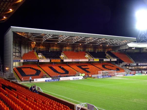
Photo: Wikimedia, CC BY-SA 3.0.
Tannadice Park, officially known as The CalForth Construction Arena for sponsorship reasons, is a football stadium in Dundee, Scotland. It is the home ground of Dundee United F.C., who have played at Tannadice since the club was founded as Dundee Hibernian in 1909. Tannadice Park is situated 1,300 feet east of Provost Road.
Coldside Library
Library

Photo: Paul McIlroy, CC BY-SA 2.0.
Coldside Library is a community library operated by Leisure and Culture Dundee. Its opening hours run from Monday to Saturday weekly. It offers book borrowing services, free Wi-Fi and computers for internet access, as well as educational activities for families and adults in the Dundee area. Coldside Library is situated 1,000 feet west of Provost Road.
Places in the Area
Nearby places include Hilltown and Woodside.
Hilltown
Suburb

Photo: Val Vannet, CC BY-SA 2.0.
Hilltown in Dundee, Scotland, is a mainly residential area to the north of the City Centre and lying to the south of the main circular road.
Woodside
Quarter
Woodside is a small housing area in the north of Dundee, Scotland. The area runs between Graham Street, Mains Loan and lengthwise to the Kingsway. The residential housing is mainly 1920s constructions with four homes to a block.
Stobswell
Suburb
 Stobswell is an area of Dundee, Scotland with a population of approximately 10,000. It was originally a small hamlet outside the city until the Industrial Revolution caused the growth of Dundee.
Provost Road
- Type: Bus stop
- Category: transportation
- Location: Dundee City, Scotland, United Kingdom, Britain and Ireland, Europe
- View on OpenStreetMap
Latitude
56.47436° or 56° 28′ 28″ northLongitude
-2.9757° or 2° 58′ 33″ westOpen location code
9C8VF2FF+PPOpenStreetMap ID
node 3189551245OpenStreetMap feature
highway=bus_stopOpenStreetMap feature
public_transport=platform
This page is based on OpenStreetMap, Wikidata, and Wikimedia Commons.
We’d love your help improving our open data sources. Thank you for contributing.
Satellite Map
Discover Provost Road from above in high-definition satellite imagery.
Places with the Same Name
Discover other places named “Provost Road”.
Notable Places Nearby
Highlights include Bobby Cox Stand and DPM Park.
Nearby Places
Explore places such as Canning Street and Dens Park.
Scotland: Must-Visit Destinations
Delve into Edinburgh, Glasgow, Aberdeen, and Dundee.
Curious Bus Stops to Discover
Uncover intriguing bus stops from every corner of the globe.
About Mapcarta. Data © OpenStreetMap contributors and available under the Open Database License". Text is available under the CC BY-SA 4.0 license, except for photos, directions, and the map. Photo: Ritchyblack, FAL.