Tenaglia di Santo Ignazio
Tenaglia di Santo Ignazio is a historic site in Fenestrelle, Province of Turin, Piedmont. Tenaglia di Santo Ignazio is situated nearby to the historic site Bastione San Carlo, as well as near Piazza d’armi.| Tap on a place to explore it |
Places of Interest Nearby
Highlights include Chiesa di San Luigi IX and Priorato di San Giusto.
Chiesa di San Luigi IX
Church

Photo: MadBob, CC BY-SA 4.0.
Chiesa di San Luigi IX is a church, which is situated 1 km northwest of Tenaglia di Santo Ignazio.
Priorato di San Giusto
Church

Photo: Bnnfrz, CC BY-SA 4.0.
Priorato di San Giusto is a church, which is situated 2 km east of Tenaglia di Santo Ignazio.
Places in the Area
Nearby places include Pracatinat and Laux.

Laux
Hamlet

Photo: raffaele sergi, CC BY 2.0.
Laux is a hamlet, which is situated 3 km northwest of Tenaglia di Santo Ignazio.
Villaretto
Hamlet
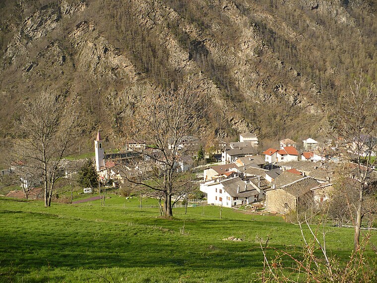
Photo: Francofranco56, Public domain.
Villaretto is a hamlet, which is situated 4½ km east of Tenaglia di Santo Ignazio.
Tenaglia di Santo Ignazio
- Type: Historic site
- Categories: tourist attraction and tourism
- Location: Fenestrelle, Province of Turin, Piedmont, Northwest Italy, Italy, Europe
- View on OpenStreetMap
Latitude
45.02875° or 45° 1′ 44″ northLongitude
7.0589° or 7° 3′ 32″ eastOpen location code
8FQ923H5+FHOpenStreetMap ID
node 3359279897OpenStreetMap feature
historic=yes
This page is based on OpenStreetMap, Wikidata, and Wikimedia Commons.
We’d love your help improving our open data sources. Thank you for contributing.
Satellite Map
Discover Tenaglia di Santo Ignazio from above in high-definition satellite imagery.
Notable Places Nearby
Highlights include Bastione San Carlo and Piazza d’armi.
Nearby Places
Explore places such as Palazzina d’entrata della Porta Reale and Padiglione degli Ufficiali e prigioni di stato.
Piedmont: Must-Visit Destinations
Delve into Turin, Novara, Asti, and Alessandria.
Curious Historic Sites to Discover
Uncover intriguing historic sites from every corner of the globe.
About Mapcarta. Data © OpenStreetMap contributors and available under the Open Database License". Text is available under the CC BY-SA 4.0 license, except for photos, directions, and the map. Photo: Toma15996, CC BY-SA 4.0.