Åsö grundskola
Åsö grundskola is a school in Katarina, Stockholm Municipality, Stockholm County. Åsö grundskola is situated nearby to the school Åso vuxengymnasium, as well as near the park Åsötorget.| Tap on a place to explore it |
Places of Interest Nearby
Highlights include Åsötorget and Saint Eric’s Cathedral.

Saint Eric’s Cathedral
Church
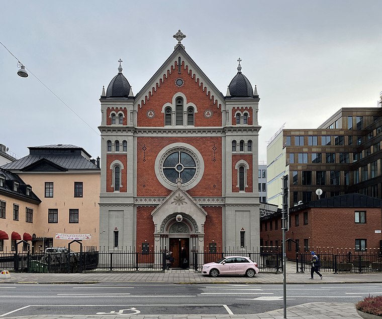
Photo: I99pema, CC BY-SA 4.0.
Saint Eric's Cathedral is a Catholic cathedral in Stockholm, Sweden. It is located on Södermalm, the southern part of central Stockholm. It was built in 1892 and was raised to the status of a cathedral in 1953, when the Catholic Diocese of Stockholm was created. Saint Eric’s Cathedral is situated 350 metres north of Åsö grundskola.

Places in the Area
Nearby places include Skanstull and Södermalm.
Skanstull
Neighborhood

Photo: Wikimedia, CC BY-SA 3.0.
Skanstull is an area in Södermalm in Stockholm. Skanstull connects the traffic between the inner city and the south parts of Stockholm and its suburbs.
Södermalm

Photo: Wikimedia, CC BY-SA 3.0.
Södermalm is the southern borough of central Stockholm, consisting of the island of Södermalm proper, two smaller islands connected to it from the west, as well as the neighbourhood of Hammarby Sjöstad on the opposite bank of the Hammarby Sjö in the east, which is a redeveloped former industrial area that was transformed into a model sustainable residential community.

Åsö grundskola
- Type: School
- Description: administrative school unit in Stockholm Municipality
- Categories: school unit and education
- Location: Katarina, Stockholm Municipality, Stockholm County, Svealand, Sweden, Nordic countries, Europe
- View on OpenStreetMap
Latitude
59.31075° or 59° 18′ 39″ northLongitude
18.07458° or 18° 4′ 29″ eastOpen location code
9FFW836F+7ROpenStreetMap ID
node 3588342404OpenStreetMap feature
amenity=schoolWikidata ID
Q89191571
This page is based on OpenStreetMap, Wikidata, and Wikimedia Commons.
We’d love your help improving our open data sources. Thank you for contributing.
Satellite Map
Discover Åsö grundskola from above in high-definition satellite imagery.
In Other Languages
From Dutch to Swedish—“Åsö grundskola” goes by many names.
- Dutch: “Åsö grundskola”
- Swedish: “Åsö grundskola”
Notable Places Nearby
Highlights include Restaurang Pelikan and Stilleben.
Nearby Places
Explore places such as Aramia and MobilCity.
Stockholm County: Must-Visit Destinations
Delve into Stockholm, Södermalm, Södertälje, and Norrmalm.
Curious Schools to Discover
Uncover intriguing schools from every corner of the globe.
About Mapcarta. Data © OpenStreetMap contributors and available under the Open Database License". Text is available under the CC BY-SA 4.0 license, except for photos, directions, and the map. Photo: Smiley.toerist, CC BY-SA 4.0.