Six Bells Roundabout
Six Bells Roundabout is a locality in Farnham, Waverley District, England. Six Bells Roundabout is situated nearby to the village Hale, as well as near the locality Shepherd and Flock Roundabout.| Tap on a place to explore it |
Places of Interest
Highlights include St John the Evangelist Church, Hale, Surrey and Farnham Hospital.
St John the Evangelist Church, Hale, Surrey
Church

Photo: RevLesley, CC BY-SA 4.0.
St John the Evangelist Church is a Church of England parish church in Hale, Surrey. Consecrated in 1844, the church is now a Grade II listed building.
Farnham Hospital
Hospital
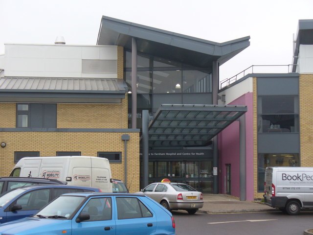
Photo: Colin Smith, CC BY-SA 2.0.
Farnham Hospital is a community hospital in Farnham, Surrey, England. It is managed by the Frimley Health NHS Foundation Trust.
Farnham Heath End School
School
Farnham Heath End School is a mixed coeducational secondary school with academy status, in Heath End, Surrey, with roughly 900 pupils.
Places in the Area
Nearby places include Hale and Weybourne.
Hale
Village
Hale is a village in Surrey, England. It lies just north of Farnham, towards Aldershot, with Badshot Lea to the east. Some maps show Lower Hale and Upper Hale, but the area between the two is indistinct.
Weybourne
Village

Photo: BabelStone, CC BY-SA 3.0.
Weybourne is a small village in Surrey, England. It lies on the outskirts of Farnham, Surrey and borders Aldershot in Hampshire.
Heath End
Neighborhood
Heath End is a village in the Waverley district of Surrey, England, traditionally part of the large town parish of Farnham. Heath End is smaller in area than most villages and does not have an Anglican church so does not meet the older criteria for villages in England.
Six Bells Roundabout
- Type: Locality
- Location: Farnham, Waverley District, Surrey, South East England, England, United Kingdom, Britain and Ireland, Europe
- View on OpenStreetMap
Latitude
51.22545° or 51° 13′ 32″ northLongitude
-0.78292° or 0° 46′ 59″ westOpen location code
9C3X66G8+5ROpenStreetMap ID
node 3658883862OpenStreetMap feature
place=locality
This page is based on OpenStreetMap, Wikidata, and Wikimedia Commons.
We’d love your help improving our open data sources. Thank you for contributing.
Satellite Map
Discover Six Bells Roundabout from above in high-definition satellite imagery.
Localities in the Area
Explore places such as Shepherd and Flock Roundabout and Upper Hale.
Notable Places Nearby
Highlights include Imaan Gardens Cemetery and Memorial Ground and Roman Way Play Area.
Surrey: Must-Visit Destinations
Delve into Guildford, Woking, Godalming, and Epsom.
Curious Localities to Discover
Uncover intriguing localities from every corner of the globe.
About Mapcarta. Data © OpenStreetMap contributors and available under the Open Database License". Text is available under the CC BY-SA 4.0 license, except for photos, directions, and the map. Photo: Lewis Hulbert, CC BY-SA 3.0.