Carnforth Pharmacy
Carnforth Pharmacy is a pharmacy in Carnforth, Lancaster, England which is located on Market Street. Carnforth Pharmacy is situated nearby to the art gallery Moore ‘n’ Wife, as well as near Carnforth Post Office.| Tap on a place to explore it |
Places of Interest Nearby
Highlights include Carnforth railway station and Christ Church.
Carnforth railway station
Railway station
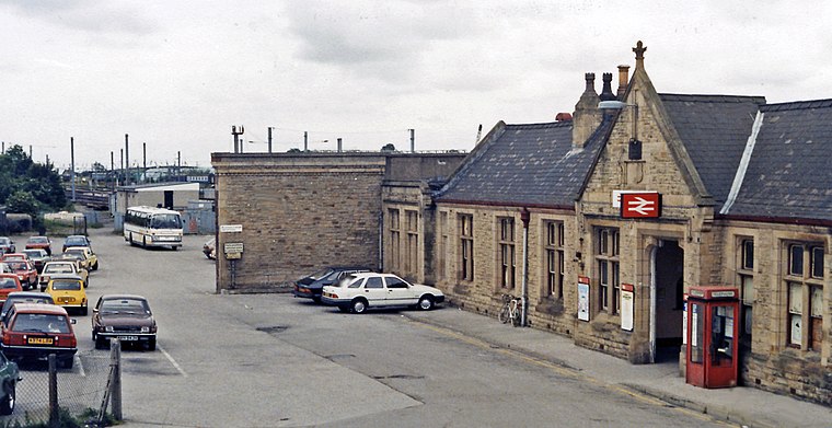
Photo: Ben Brooksbank, CC BY-SA 2.0.
Carnforth is a railway station on the Bentham and Furness Lines, sited 6 miles north of Lancaster, England; it serves the market town of Carnforth, in Lancashire, England. It is owned by Network Rail and managed by Northern Trains. Carnforth railway station is situated 550 feet northwest of Carnforth Pharmacy.
Christ Church
Church
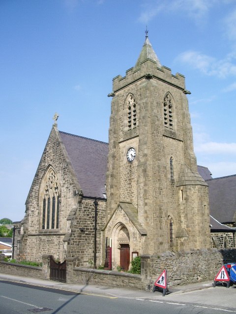
Photo: Alexander P Kapp, CC BY-SA 2.0.
Christ Church is situated 410 feet southeast of Carnforth Pharmacy.
Carnforth High School
School
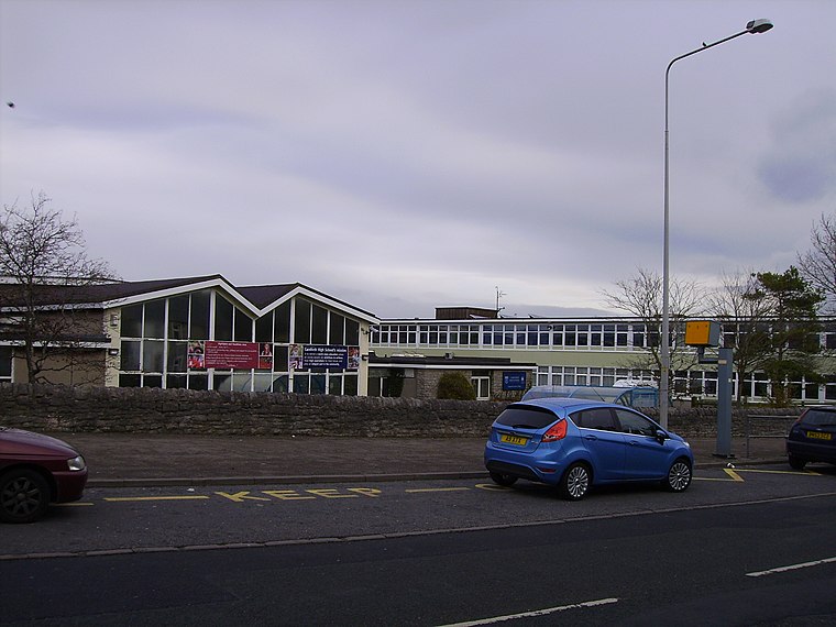
Photo: Ronhjones, CC BY-SA 3.0.
Carnforth High School is a coeducational secondary school located in Carnforth, Lancashire, England. The school previously held specialist Science College status. Carnforth High School is situated 2,200 feet southeast of Carnforth Pharmacy.
Places in the Area
Nearby places include Borwick and Priest Hutton.
Borwick
Village

Photo: Alexander P Kapp, CC BY-SA 2.0.
Borwick is a village and civil parish in the City of Lancaster district of Lancashire, England, about 8 miles north of Lancaster, on the Lancaster Canal. Borwick is situated 2½ miles northeast of Carnforth Pharmacy.
Priest Hutton
Village

Photo: David Medcalf, CC BY-SA 2.0.
Priest Hutton is a village and civil parish in Lancashire, England. It is located 5 kilometres north east of Carnforth, in the City of Lancaster, close to the boundary with Cumbria. Priest Hutton is situated 3 miles northeast of Carnforth Pharmacy.
Yealand Storrs
Hamlet

Photo: Tom Richardson, CC BY-SA 2.0.
Yealand Storrs is a hamlet in the English county of Lancashire. Yealand Storrs is situated 3½ miles north of Carnforth Pharmacy.
Carnforth Pharmacy
- Type: Pharmacy
- Address: 9 Market Street, Carnforth, LA5 9JX
- Category: health care
- Location: Carnforth, Lancaster, Lancashire, North West England, England, United Kingdom, Britain and Ireland, Europe
- View on OpenStreetMap
Latitude
54.12893° or 54° 7′ 44″ northLongitude
-2.76921° or 2° 46′ 9″ westOpen location code
9C6V46HJ+H8OpenStreetMap ID
node 3706629821OpenStreetMap feature
amenity=pharmacyOpenStreetMap feature
healthcare=pharmacy
This page is based on OpenStreetMap, Wikidata, and Wikimedia Commons.
We’d love your help improving our open data sources. Thank you for contributing.
Satellite Map
Discover Carnforth Pharmacy from above in high-definition satellite imagery.
Notable Places Nearby
Highlights include Moore ‘n’ Wife and The Salvation Army.
Nearby Places
Explore places such as Greggs and Carnforth Carpets.
Lancashire: Must-Visit Destinations
Delve into Blackpool, Blackburn, Preston, and Burnley.
Curious Pharmacies to Discover
Uncover intriguing pharmacies from every corner of the globe.
About Mapcarta. Data © OpenStreetMap contributors and available under the Open Database License". Text is available under the CC BY-SA 4.0 license, except for photos, directions, and the map. Photo: Jay Son, CC BY-SA 3.0.