Fienili Cornitella
Fienili Cornitella is a locality in Berzo Demo, Province of Brescia, Lombardy and has an elevation of 1,431 metres. Fienili Cornitella is situated nearby to the locality Fienili Desnoar, as well as near Ölgia.| Tap on a place to explore it |
Places of Interest
Highlights include Berzo Demo and Saviore dell’Adamello.
Berzo Demo
Town hall
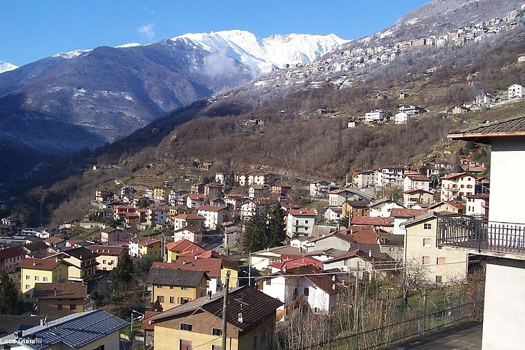
Photo: Wikimedia, CC BY-SA 3.0.
Berzo Demo is an Italian comune in Val Camonica, province of Brescia, in Lombardy, northern Italy.
Saviore dell’Adamello
Town hall

Photo: Wikimedia, CC BY-SA 3.0.
Saviore dell'Adamello is a comune in the province of Brescia, in Lombardy, Italy. It is bounded by the commune of Cevo. It is located in the Val Camonica region, southwest of Mount Adamello. Saviore dell’Adamello is situated 3½ km southeast of Fienili Cornitella.

Places in the Area
Nearby places include Demo and Andrista.


Garda
Hamlet

Photo: Lkcl it, CC BY-SA 4.0.
Garda is a hamlet, which is situated 3 km north of Fienili Cornitella.
Fienili Cornitella
- Type: Locality
- Location: Berzo Demo, Province of Brescia, Lombardy, Northwest Italy, Italy, Europe
- View on OpenStreetMap
Latitude
46.09972° or 46° 5′ 59″ northLongitude
10.36431° or 10° 21′ 52″ eastElevation
1,431 metres (4,695 feet)Open location code
8FRG39X7+VPOpenStreetMap ID
node 3806621163OpenStreetMap feature
place=locality
This page is based on OpenStreetMap, Wikidata, and Wikimedia Commons.
We’d love your help improving our open data sources. Thank you for contributing.
Satellite Map
Discover Fienili Cornitella from above in high-definition satellite imagery.
Localities in the Area
Explore places such as Fienili Desnoar and Ölgia.
Notable Places Nearby
Highlights include Malga Pian Piccolo and Dò della Rocca.
Lombardy: Must-Visit Destinations
Delve into Milan, Bergamo, Brescia, and Mantua.
Curious Localities to Discover
Uncover intriguing localities from every corner of the globe.
About Mapcarta. Data © OpenStreetMap contributors and available under the Open Database License". Text is available under the CC BY-SA 4.0 license, except for photos, directions, and the map. Photo: Lkcl it, CC BY-SA 3.0.