Luera del Luf
Luera del Luf is a mine in Berzo Demo, Province of Brescia, Lombardy. Luera del Luf is situated nearby to the church Chiesa dei Morti di Peste, as well as near the railway stop Forno d’Allione railway halt.| Tap on a place to explore it |
Places of Interest Nearby
Highlights include Berzo Demo and Malonno.
Berzo Demo
Town hall
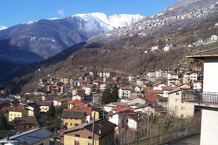
Photo: Wikimedia, CC BY-SA 3.0.
Berzo Demo is an Italian comune in Val Camonica, province of Brescia, in Lombardy, northern Italy. Berzo Demo is situated 1 km northeast of Luera del Luf.
Malonno
Town hall

Photo: Wikimedia, CC BY-SA 3.0.
Malonno is a town and comune in the province of Brescia, in Lombardy, northern Italy. Neighbouring communes are Berzo Demo, Paisco Loveno and Sonico. It is located on the right bank of the river Oglio, in the Val Camonica. Malonno is situated 3½ km north of Luera del Luf.
Sellero
Town hall

Photo: Wikimedia, CC BY-SA 3.0.
Sellero is a comune of 1,503 people in the province of Brescia in the middle Val Camonica. In its territory there are thousands of rock engravings, including the "Rosa camuna" in Carpene. Sellero is situated 4 km southeast of Luera del Luf.
Places in the Area
Nearby places include Demo and Andrista.


Paisco
Village

Photo: Wikimedia, CC BY-SA 3.0.
Paisco is a village, which is situated 2½ km west of Luera del Luf.
Luera del Luf
- Type: Mine
- Categories: historic site and industry
- Location: Berzo Demo, Province of Brescia, Lombardy, Northwest Italy, Italy, Europe
- View on OpenStreetMap
Latitude
46.0878° or 46° 5′ 16″ northLongitude
10.32374° or 10° 19′ 26″ eastOpen location code
8FRG38QF+4FOpenStreetMap ID
node 390958609OpenStreetMap feature
historic=mine
This page is based on OpenStreetMap, Wikidata, and Wikimedia Commons.
We’d love your help improving our open data sources. Thank you for contributing.
Satellite Map
Discover Luera del Luf from above in high-definition satellite imagery.
Notable Places Nearby
Highlights include Chiesa dei Morti di Peste and Forno d’Allione railway halt.
Nearby Places
Explore places such as Parco Regionale dell’Adamello and Fullshade.
Lombardy: Must-Visit Destinations
Delve into Milan, Bergamo, Brescia, and Mantua.
Curious Mines to Discover
Uncover intriguing mines from every corner of the globe.
About Mapcarta. Data © OpenStreetMap contributors and available under the Open Database License". Text is available under the CC BY-SA 4.0 license, except for photos, directions, and the map. Photo: Lkcl it, CC BY-SA 3.0.