Observatietoren
Observatietoren is a work of art in Nijmegen, Gelderland. Observatietoren is situated nearby to Jack’s Casino, as well as near the ice rink Triavium.| Tap on a place to explore it |
Photo: Michielverbeek, CC BY-SA 4.0.
- Type: Work of art
- Artwork type: sculpture
- Description: public artwork by Ronald Tolman in Nijmegen, the Netherlands
Places of Interest Nearby
Highlights include Nijmegen Dukenburg railway station and Triavium.
Nijmegen Dukenburg railway station
Railway station
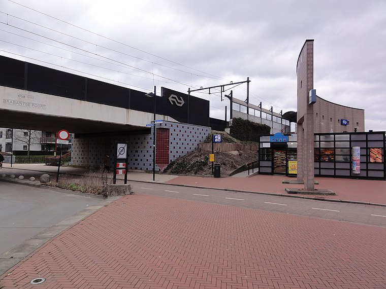
Photo: Havang(nl), CC0.
Nijmegen Dukenburg is a railway station located in the south west of Nijmegen, Netherlands. The station was opened on 2 June 1973 and is located on the Tilburg–Nijmegen railway. Nijmegen Dukenburg railway station is situated 270 metres northeast of Observatietoren.
Triavium
Ice rink

Photo: Havang(nl), CC0.
Triavium is an ice rink, which is situated 160 metres northwest of Observatietoren.
Winkelcentrum Dukenburg
Shopping center

Photo: Havang(nl), CC0.
Winkelcentrum Dukenburg is a shopping center, which is situated 330 metres northeast of Observatietoren.
Places in the Area
Nearby places include ‘t Broek and Lankforst.


Observatietoren
- Categories: sculpture and tourism
- Location: Nijmegen, Gelderland, Eastern Netherlands, Netherlands, Benelux, Europe
- View on OpenStreetMap
Latitude
51.82183° or 51° 49′ 19″ northLongitude
5.79223° or 5° 47′ 32″ eastHeight
15 metres (49 feet)Open location code
9F37RQCR+PVOpenStreetMap ID
node 4093949832OpenStreetMap feature
tourism=artworkOpenStreetMap attribute
artwork_type=sculptureWikidata ID
Q105287786
This page is based on OpenStreetMap, Wikidata, and Wikimedia Commons.
We’d love your help improving our open data sources. Thank you for contributing.
Satellite Map
Discover Observatietoren from above in high-definition satellite imagery.
In Other Languages
“Observatietoren” goes by many names.
- Dutch: “Observatietoren”
Notable Places Nearby
Highlights include Jack’s Casino and Station Dukenburg.
Nearby Places
Explore places such as De Heeren van Nijmegen and Digital Phoneshop.
Gelderland: Must-Visit Destinations
Delve into Arnhem, Apeldoorn, Ede, and Zutphen.
Curious Work Of Arts to Discover
Uncover intriguing work of arts from every corner of the globe.
About Mapcarta. Data © OpenStreetMap contributors and available under the Open Database License". Text is available under the CC BY-SA 4.0 license, except for photos, directions, and the map. Photo: Michielverbeek, CC BY-SA 4.0.