Kim’s Brasserie
Kim’s Brasserie is a restaurant in Lanaken, Arrondissement of Tongeren, Flanders. Kim’s Brasserie is situated nearby to the cemetery Militair Kerkhof, as well as near Begraafplaats Veldwezelt.| Tap on a place to explore it |
Places of Interest Nearby
Highlights include Sint-Lambertuskerk and Sint-Quintinuskerk.
Sint-Lambertuskerk
Church

Photo: Paul Hermans, CC BY-SA 4.0.
Sint-Lambertuskerk is a church, which is situated 630 metres north of Kim’s Brasserie.
Sint-Quintinuskerk
Church

Photo: Paul Hermans, CC BY-SA 4.0.
Sint-Quintinuskerk is a church, which is situated 2½ km southwest of Kim’s Brasserie.
Sint-Michielskerk
Church
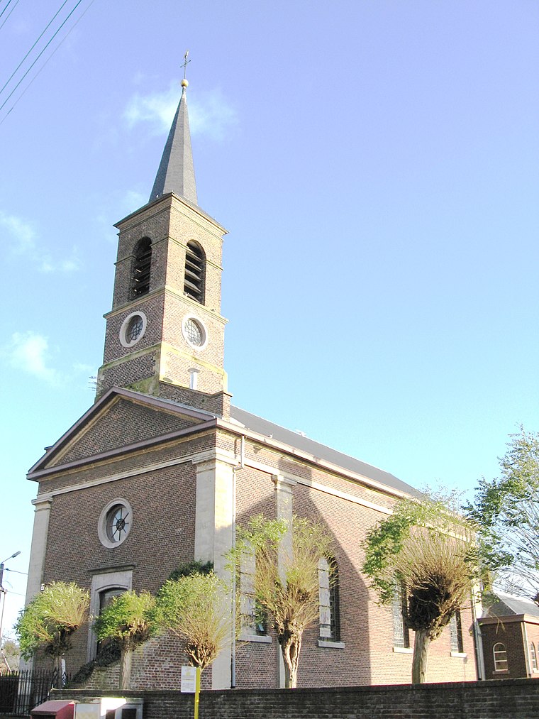
Photo: Sonuwe, CC BY-SA 3.0.
Sint-Michielskerk is a church, which is situated 2½ km south of Kim’s Brasserie.
Places in the Area
Nearby places include Veldwezelt and Lanakerveld.
Lanakerveld
Neighborhood

Photo: Paul Hermans, CC BY-SA 4.0.
Lanakerveld is a neighborhood, which is situated 2½ km northeast of Kim’s Brasserie.
Gellik
Village

Photo: Sonuwe, CC BY-SA 3.0.
Gellik is a village, which is situated 3 km northwest of Kim’s Brasserie.
Kim’s Brasserie
- Type: Restaurant
- Category: food
- Location: Lanaken, Arrondissement of Tongeren, Limburg, Flanders, Belgium, Benelux, Europe
- View on OpenStreetMap
Latitude
50.86007° or 50° 51′ 36″ northLongitude
5.63529° or 5° 38′ 7″ eastOpen location code
9F27VJ6P+24OpenStreetMap ID
node 4319187063OpenStreetMap feature
amenity=restaurant
This page is based on OpenStreetMap, Wikidata, and Wikimedia Commons.
We’d love your help improving our open data sources. Thank you for contributing.
Satellite Map
Discover Kim’s Brasserie from above in high-definition satellite imagery.
Notable Places Nearby
Highlights include Militair Kerkhof and Begraafplaats Veldwezelt.
Nearby Places
Explore places such as Veldwezelt Brug Albertkanaal and Veldwezelt Lindestraat.
Limburg: Must-Visit Destinations
Delve into Sint-Truiden, Hasselt, Tongeren, and Genk.
Curious Restaurants to Discover
Uncover intriguing restaurants from every corner of the globe.
About Mapcarta. Data © OpenStreetMap contributors and available under the Open Database License". Text is available under the CC BY-SA 4.0 license, except for photos, directions, and the map. Photo: Paul Hermans, CC BY-SA 3.0.