Wire Lock
Wire Lock is a lock on the Kennet and Avon Canal, near Hungerford, Berkshire, England. It is a grade II listed building.| Tap on a place to explore it |
Photo: Jonathan Billinger, CC BY-SA 2.0.
Places of Interest Nearby
Highlights include Hungerford railway station and Kintbury railway station.
Hungerford railway station
Railway station
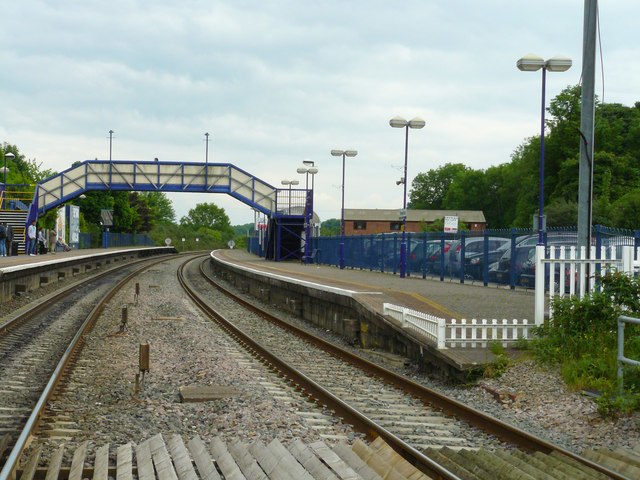
Photo: Chris Talbot, CC BY-SA 2.0.
Hungerford railway station is a railway station that serves the historic market town of Hungerford in Berkshire, England. It is 61 miles 43 chains measured from the zero point at London Paddington. Hungerford railway station is situated 1½ miles west of Wire Lock.
Kintbury railway station
Railway station

Photo: Ben Brooksbank, CC BY-SA 2.0.
Kintbury railway station serves the village of Kintbury in Berkshire, England. It is situated on the Reading to Taunton Line, 58 miles 38 chains from London Paddington. Kintbury railway station is situated 1½ miles east of Wire Lock.
Hungerford Town Hall
Town hall

Photo: Chris Talbot, CC BY-SA 2.0.
Hungerford Town Hall is a municipal building in the High Street, Hungerford, Berkshire, England. The town hall, which is the meeting place of Hungerford Town Council, is a Grade II listed building. Hungerford Town Hall is situated 1½ miles west of Wire Lock.
Places in the Area
Nearby places include Avington and Lower Denford.
Avington
Hamlet

Photo: Basher Eyre, CC BY-SA 2.0.
Avington is a village and former civil parish, now in the parish of Kintbury, in the West Berkshire district, in the ceremonial county of Berkshire, England.
Lower Denford
Hamlet

Photo: Colin Bates, CC BY-SA 2.0.
Lower Denford is a hamlet in the civil parish of Kintbury in the English county of Berkshire. The settlement lies adjacent to the A4 road, and is located approximately 1 mile east of Hungerford.
Upper Denford
Hamlet
Upper Denford is a hamlet in Berkshire, England, and part of the civil parish of Kintbury. The settlement lies north of the A4 road, and is located approximately 1.5 miles north-east of Hungerford.
Wire Lock
- Type: Lock gate
- Description: lock on Kennet And Avon Canal
- Categories: lock, road bridge, and transportation
- Location: Kintbury, West Berkshire, England, United Kingdom, Britain and Ireland, Europe
- View on OpenStreetMap
Latitude
51.4104° or 51° 24′ 37″ northLongitude
-1.47976° or 1° 28′ 47″ westHeight
6.8 feet (2.1 metres)Open location code
9C3WCG6C+53OpenStreetMap ID
node 442730217OpenStreetMap feature
waterway=lock_gateWikidata ID
Q3577619
This page is based on OpenStreetMap, Wikidata, Wikimedia Commons, and Wikipedia.
We’d love your help improving our open data sources. Thank you for contributing.
Satellite Map
Discover Wire Lock from above in high-definition satellite imagery.
In Other Languages
“Wire Lock” goes by many names.
- French: “écluse de Wire”
- French: “Écluse de Wire”
Notable Places Nearby
Highlights include Wire Lock and Sling’s Firs.
Nearby Places
Explore places such as Wire Lock and Keeper Cottage.
England: Must-Visit Destinations
Delve into London, Manchester, Sheffield, and Leeds.
Curious Lock Gates to Discover
Uncover intriguing lock gates from every corner of the globe.
About Mapcarta. Data © OpenStreetMap contributors and available under the Open Database License". Text is available under the CC BY-SA 4.0 license, except for photos, directions, and the map. Description text is based on the Wikipedia page “Wire Lock”. Photo: Jonathan Billinger, CC BY-SA 2.0.