Instituto Ferrini
Instituto Ferrini is a school in Bomboná No.1, La Candelaria, Antioquia. Instituto Ferrini is situated nearby to the theater building Porfirio Barba Jacob, as well as near La Amante.| Tap on a place to explore it |
Places of Interest Nearby
Highlights include Iglesia de San Ignacio, Medellín and Parque de San Antonio, Medellín.
Iglesia de San Ignacio, Medellín
Church

Photo: SajoR, Public domain.
Iglesia de San Ignacio, Medellín is a church, which is situated 230 metres northwest of Instituto Ferrini.
Parque de San Antonio, Medellín
Park

Photo: XalD, CC BY-SA 3.0.
Parque de San Antonio, Medellín is a park, which is situated 610 metres west of Instituto Ferrini.
Teatro Lido
Theater building
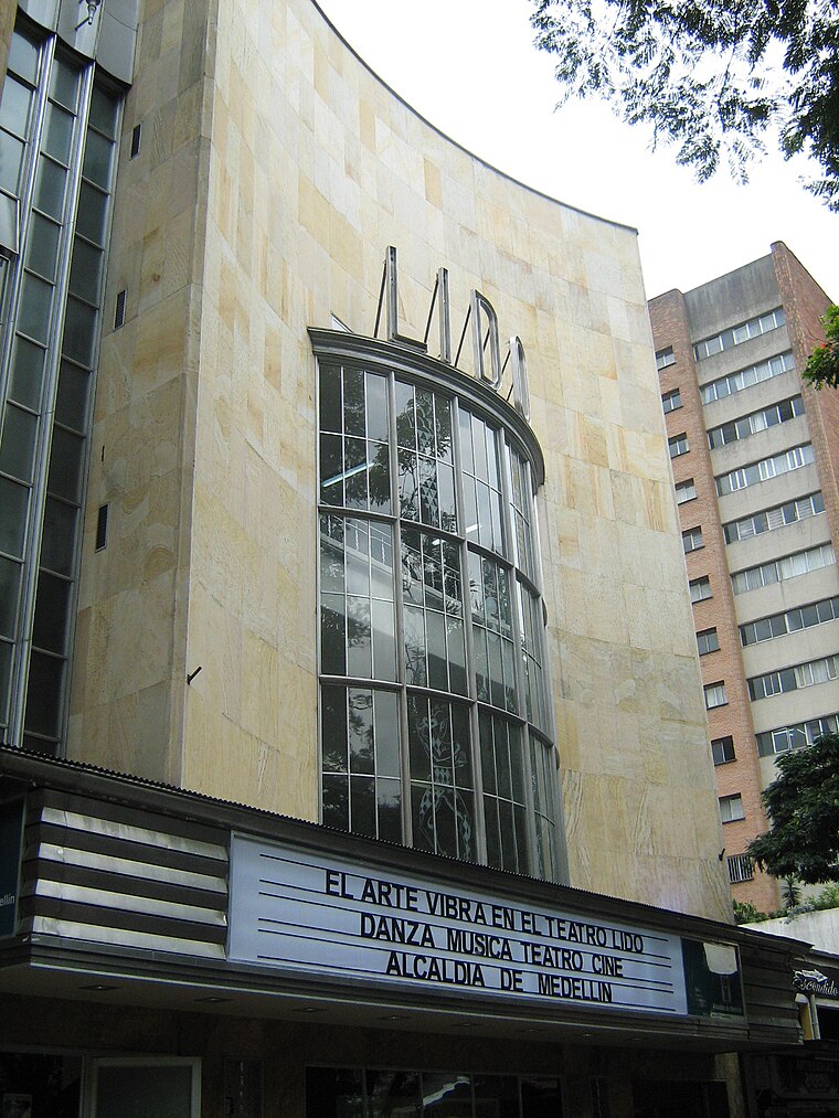
Photo: SajoR, CC BY-SA 3.0.
The Teatro Lido is a Colombian theater located at the southeastern coast of Park of Bolívar, in Medellín. The theater began operating in 1945 and in 2007, after a methodical restoration was reopened, and is administered by the Mayor of Medellin. Teatro Lido is situated 1 km north of Instituto Ferrini.
Places in the Area
Nearby places include Aranjuez and Robledo.
Aranjuez
Suburb

Photo: SajoR, Public domain.
Aranjuez is a suburb, which is situated 3½ km north of Instituto Ferrini.
Robledo
Suburb

Photo: SajoR, CC BY-SA 2.5.
Robledo is a suburb, which is situated 5 km northwest of Instituto Ferrini.
El Poblado
Suburb

Photo: Pedro Felipe, CC BY-SA 4.0.
El Poblado is the 14th commune in the metropolitan area of the city of Medellín, Colombia. According to a 2005 census the population was 94,704, distributed among its land area of 23 km2, and by the year 2015, it had a population of 128,839. El Poblado is situated 5 km south of Instituto Ferrini.
Instituto Ferrini
- Type: School
- Category: education
- Location: Bomboná No.1, La Candelaria, Medellín, Antioquia, Andino, Colombia, South America
- View on OpenStreetMap
Latitude
6.24464° or 6° 14′ 41″ northLongitude
-75.5627° or 75° 33′ 46″ westOpen location code
67R66CVP+VWOpenStreetMap ID
node 4464453390OpenStreetMap feature
amenity=school
This page is based on OpenStreetMap, Wikidata, and Wikimedia Commons.
We’d love your help improving our open data sources. Thank you for contributing.
Satellite Map
Discover Instituto Ferrini from above in high-definition satellite imagery.
In Other Languages
“Instituto Ferrini” goes by many names.
- Spanish: “Instituto Ferrini”
Places with the Same Name
Discover other places named “Instituto Ferrini”.
Notable Places Nearby
Highlights include Porfirio Barba Jacob and La Amante.
Nearby Places
Explore places such as Torre Libertadores and Göra.
Antioquia: Must-Visit Destinations
Delve into Santa Fe de Antioquia, Guatape, Jardín, and Turbo.
Curious Schools to Discover
Uncover intriguing schools from every corner of the globe.
About Mapcarta. Data © OpenStreetMap contributors and available under the Open Database License". Text is available under the CC BY-SA 4.0 license, except for photos, directions, and the map. Photo: Dr EG, CC BY 2.0.