Casa de Don Victor
Casa de Don Victor is a campsite in Candelaria, Bogotá D.C., Bogotá. Casa de Don Victor is situated nearby to the garden Jardín Urbano, as well as near Jardín restauración.| Tap on a place to explore it |
Places of Interest Nearby
Highlights include Gold Museum and Monserrate.
Gold Museum
Museum
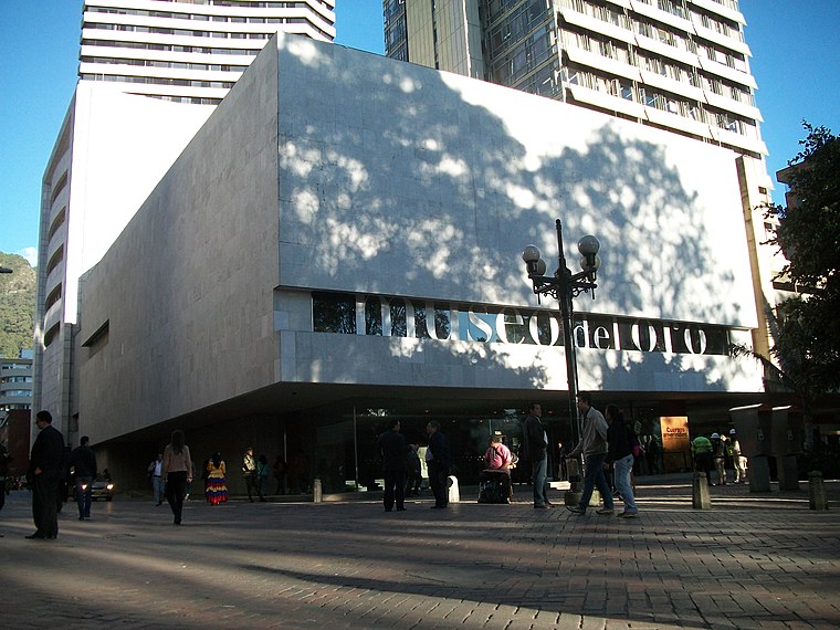
Photo: Pedro Felipe, CC BY-SA 3.0.
The Museum of Gold is an archaeology museum located in Bogotá, Colombia. It is one of the most visited touristic highlights in the country. The museum receives around 500,000 tourists per year. Gold Museum is situated 1¼ km northwest of Casa de Don Victor.
Monserrate
Peak

Photo: Pedro Felipe, CC BY-SA 4.0.
Monserrate is a mountain over 3,000 metres high that overlooks the city center of Bogotá, the capital city of Colombia. It rises to 3,152 meters above the sea level, where there is a church with a shrine, devoted to El Señor Caído.
Guadalupe Hill
Peak

Photo: Mussi Katz, CC0.
Guadalupe Hill is a 3,360-metre high hill located in the Eastern Hills, uphill from the centre of Bogotá, Colombia. Together with its neighbouring hill Monserrate it is one of the landmarks of Bogotá.
Places in the Area
Nearby places include La Candelaria and Laches.
La Candelaria
 La Candelaria is the historic center of Bogotá, and the city's principal destination for tourists. Home to the top museums, the government palaces, and beautiful old colonial buildings along narrow cobblestone streets, it's a must see.
Laches
Neighborhood
Laches is a neighbourhood of Bogotá, Colombia. It is in the Santa Fe district in east-central Bogotá, on the edge of the forest reserve. Historically, the population was very poor, and continued to be so well into the twenty-first century.
Santa Fe
Suburb

Photo: Baiji, CC BY-SA 3.0.
Santa Fe is the third locality of Bogotá, the Capital District of Colombia. Santa Fe is part of the traditional downtown area where Bogotá was founded by Gonzalo Jiménez de Quesada on August 6, 1538.
Casa de Don Victor
- Type: Campsite
- Categories: tourism and camping
- Location: Candelaria, Bogotá D.C., Bogotá, Andino, Colombia, South America
- View on OpenStreetMap
Latitude
4.59643° or 4° 35′ 47″ northLongitude
-74.06122° or 74° 3′ 40″ westOpen location code
67P7HWWQ+HGOpenStreetMap ID
node 4676530996OpenStreetMap feature
tourism=camp_site
This page is based on OpenStreetMap, Wikidata, and Wikimedia Commons.
We’d love your help improving our open data sources. Thank you for contributing.
Satellite Map
Discover Casa de Don Victor from above in high-definition satellite imagery.
In Other Languages
“Casa de Don Victor” goes by many names.
- Spanish: “Casa de Don Victor”
Notable Places Nearby
Highlights include Jardín Urbano and Jardín restauración.
Nearby Places
Explore places such as Panel Informativo 2 and Panel Informativo 1.
Bogotá: Must-Visit Destinations
Delve into La Candelaria, Zona Rosa, Santa Fé-Los Mártires, and Usaquén.
Curious Campsites to Discover
Uncover intriguing campsites from every corner of the globe.
About Mapcarta. Data © OpenStreetMap contributors and available under the Open Database License". Text is available under the CC BY-SA 4.0 license, except for photos, directions, and the map. Photo: Wikimedia, CC BY-SA 3.0.