Аллея связистов Дона
Аллея связистов Дона is a monument in Rostov Oblast, Southern Russia. Аллея связистов Дона is situated nearby to the railway station Pobeda, as well as near the community center ДК ‘Ростсельмаш’.| Tap on a place to explore it |
Places of Interest Nearby
Highlights include Olimp-2 and Nikolai Ostrovsky Recreation Park.
Olimp-2
Stadium

Photo: Dmitry Zotov, CC BY-SA 4.0.
Olimp-2 is a football stadium in Rostov-on-Don, Russia. From 1930 to 2018 it was the home ground of FC Rostov, and in 1958–1970 it was also the home ground of SKA Rostov-on-Don. Olimp-2 is situated 640 metres south of Аллея связистов Дона.
Nikolai Ostrovsky Recreation Park
Park

Photo: Nadiaa1995, CC BY-SA 4.0.
Nikolai Ostrovsky Recreation Park is the biggest theme park in Rostov-on-Don. It was established in 1894 and is named after Nikolai Ostrovsky, a Soviet writer.
St. Karapet’s Church, Rostov-on-Don
Church

Photo: Wikimedia, Copyrighted free use.
Church of Saint Karapet is the only Armenian Church in Nakhichevan-on-Don which has survived to the present day. It is situated on the territory of the Armenian Cemetery near its eastern fence. St. Karapet’s Church, Rostov-on-Don is situated 1½ km southwest of Аллея связистов Дона.
Places in the Area
Nearby places include Nakhichevan and Alexandrovka.
Nakhichevan
Suburb
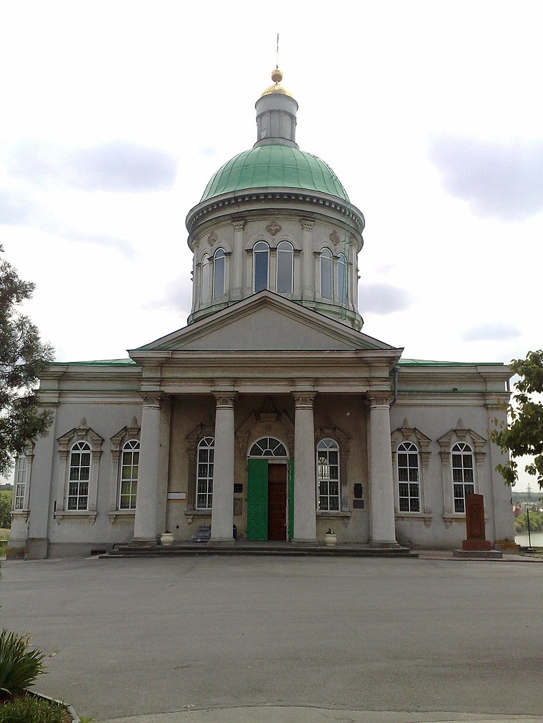
Photo: Elegant’s, Public domain.
Nakhichevan-on-Don, also known as New Nakhichevan, was an Armenian-populated town near Rostov-on-Don, in southern Russia founded in 1779 by Armenians from Crimea. It retained the status of a city until 1928 when it was merged with Rostov.
Alexandrovka
Suburb

Photo: Wikimedia, CC BY-SA 4.0.
Alexandrovka is a suburb, which is situated 4 km southeast of Аллея связистов Дона.
Солдатская слобода
Suburb

Photo: Wikimedia, Public domain.
Солдатская слобода is a suburb, which is situated 5 km southwest of Аллея связистов Дона.
Аллея связистов Дона
- Type: Monument
- Category: historic site
- Location: Rostov Oblast, Southern Russia, Russia, Eastern Europe, Europe
- View on OpenStreetMap
Latitude
47.24872° or 47° 14′ 55″ northLongitude
39.76342° or 39° 45′ 48″ eastOpen location code
8GVX6QX7+F9OpenStreetMap ID
node 4727890790OpenStreetMap feature
historic=monument
This page is based on OpenStreetMap, Wikidata, and Wikimedia Commons.
We’d love your help improving our open data sources. Thank you for contributing.
Satellite Map
Discover Аллея связистов Дона from above in high-definition satellite imagery.
In Other Languages
“Аллея связистов Дона” goes by many names.
- Russian: “Аллея связистов Дона”
Notable Places Nearby
Highlights include Pobeda and ДК ‘Ростсельмаш’.
Nearby Places
Explore places such as Вкуснолюбов and Памятник Ростсельмашевцам.
Curious Monuments to Discover
Uncover intriguing monuments from every corner of the globe.
About Mapcarta. Data © OpenStreetMap contributors and available under the Open Database License". Text is available under the CC BY-SA 4.0 license, except for photos, directions, and the map. Photo: Ymblanter, CC BY-SA 4.0.